 By Bobby Rahm · August 9, 2026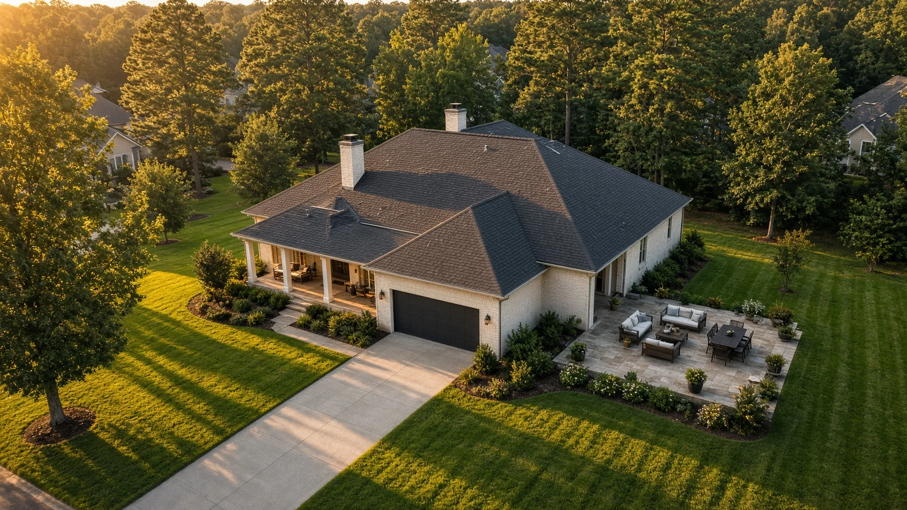
A drone camera sees your property differently than a person standing at the curb. It can show the shape of the lot, the relationship between the home and driveway, the backyard layout, nearby trees, roof condition, outdoor features, and the surrounding neighborhood in a single frame.
That wider view is useful for buyers, but it is not forgiving. A trash can hidden beside the garage may be obvious from above. So can garden hoses, roof debris, faded patio furniture, a half-finished landscaping project, or six vehicles crowding the driveway.
The goal is not to make the property look artificial. It is to remove distractions so buyers can quickly understand the home and its setting.
Start With the View Buyers Will See From Above
Walk outside and stop thinking only about curb appeal. Look at the entire property as a collection of shapes and surfaces:
- Roof
- Driveway
- Walkways
- Front and back yards
- Decks, patios, pools, sheds, and fences
- Vehicles and trailers
- Trees and large landscaping beds
- Neighboring areas that may enter the frame
A drone image often includes several of these at once. Cleaning one area while ignoring the others can make the property look unfinished.
Before photo day, ask your Realtor or photographer which features matter most to the listing. A large backyard, corner lot, detached workshop, pool, lake access, acreage, or new roof may deserve specific aerial angles. That affects where the drone flies and what should receive the most attention.
Clear the Driveway and Parking Areas
Vehicles are among the largest visual distractions in aerial property photos. They can hide the driveway, block the front elevation, cast large shadows, and make the lot feel crowded.
When possible:
- Move personal vehicles away from the property during the shoot.
- Remove trailers, utility equipment, motorcycles, and recreational vehicles unless they are relevant to the property’s use.
- Ask contractors or lawn crews not to arrive during the scheduled photo window.
- Avoid parking directly across the street if the vehicle will still dominate the wider neighborhood view.
If a vehicle cannot be moved, tell the photographer in advance. The pilot may be able to choose an angle that reduces its impact, but that is easier to plan before the flight begins.
Clean Up the Yard for the Aerial View
Small items can become surprisingly noticeable when they create bright colors or irregular patterns against grass, concrete, or roofing.
Remove or organize:
- Trash and recycling bins
- Garden hoses
- Children’s toys
- Pet bowls, leashes, and waste
- Loose tools
- Bags of soil or mulch
- Portable basketball goals when practical
- Temporary signs
- Empty planters
- Pool-cleaning equipment
- Folded tarps and covers
Mow the lawn far enough ahead that clippings are removed and the surface has time to settle. Fresh mowing lines can look good from above, but piles of clippings or a mower left near the shed will draw attention.
Trim obvious overgrowth around walkways, fences, decks, and the front elevation. You do not need a complete landscaping renovation. Concentrate on clean edges, clear paths, and removing objects that make the property feel neglected.
Pay Attention to the Roofline
Aerial photos may show more of the roof than any ground-level image. Sellers often forget this because the roof is not part of their normal daily view.
From the ground, check for visible distractions such as:
- Branches or heavy leaf buildup
- Loose holiday decorations
- Temporary tarps
- Unsecured objects
- Clogged-looking gutters
- Satellite equipment or cables hanging out of place
Do not climb onto the roof simply to prepare for photography. Roof work can be dangerous and may require a qualified professional. The practical goal is to notice obvious issues early enough to address them safely, not to create a new risk the morning of the shoot.
Drone listing photography is also not a substitute for a roof inspection. Marketing images may help show the home’s appearance and layout, but buyers should not treat them as a professional condition assessment.
Stage Outdoor Living Areas
A deck, patio, porch, pool, firepit, or outdoor kitchen may be one of the property’s strongest selling points. From the air, these spaces look best when their purpose is immediately clear.
For a patio or deck:
- Straighten chairs and tables.
- Open an umbrella only if weather and wind allow.
- Remove worn covers and storage containers.
- Sweep visible debris.
- Arrange furniture so walking space is clear.
For a pool:
- Remove the cleaner and loose accessories.
- Straighten furniture.
- Clear towels, toys, and chemical containers.
- Make sure gates are closed and the area is secure.
For a firepit or gathering space, create a simple, orderly layout. Too many chairs or scattered objects can make the area feel smaller from above.
Coordinate Pets, Children, and Visitors
The property should be as quiet and controlled as practical during the flight. Keep pets indoors, and make sure children and visitors know a drone will be operating outside.
The Federal Aviation Administration regulates commercial small-drone work under Part 107. Rules for flying over people depend on the aircraft and operating conditions, and a responsible pilot plans the flight to avoid unnecessary exposure. Clearing the yard gives the pilot more options and reduces delays.
Do not assume the photographer can simply fly anywhere over anyone. The pilot remains responsible for the operation and may change or cancel a planned angle when people, traffic, weather, airspace, or another hazard makes it unsuitable.
Tell Nearby Neighbors When It Makes Sense
A brief heads-up can prevent confusion, especially when homes are close together or the desired angle includes a shared fence line.
You do not need to make the flight a neighborhood event. A simple notice that a licensed photographer will be taking exterior listing images at a certain time is usually enough.
The photographer should still frame the property carefully and avoid unnecessary focus on neighboring private areas. Sellers should also review completed images with their Realtor before publication and remove any image that reveals something inappropriate or distracts from the listing.
Choose the Right Time of Day
Light changes the appearance of every outdoor surface. The best time depends on the direction the home faces, tree cover, weather, and the features being emphasized.
Morning may provide cleaner light on one elevation while leaving the backyard in shadow. Late afternoon may warm the front of the house but create long tree shadows across the yard. Midday can reduce long shadows, though the light may appear harsher.
Ask the photographer to choose the time based on the property rather than a generic rule. If the pool, rear deck, mountain view, lake, or front elevation is the main feature, the sun’s position around that feature matters more than a standard “golden hour” recommendation.
Weather matters too. Strong wind may make a flight unsafe or produce unstable foliage and pool surfaces. Rain, low clouds, haze, or severe glare can also reduce image quality. Build enough flexibility into the listing schedule for a weather-related change.
Ask the Pilot About Airspace Before Photo Day
Some homes are close to airports or inside controlled airspace. Commercial drone pilots may need Federal Aviation Administration authorization before flying in those locations. The FAA provides LAANC and other authorization processes for eligible Part 107 operations.
This is the pilot’s responsibility, but sellers and Realtors can help by providing the exact address early. Do not wait until the photographer is standing in the driveway to mention that the home is beside an airport, hospital heliport, stadium, military installation, or other sensitive location.
Airspace approval does not guarantee that conditions will be safe on the scheduled day. The pilot must still assess weather, nearby aircraft, temporary restrictions, people, vehicles, obstacles, and the condition of the takeoff area.
Prepare a Simple Shot Priority List
A shot list should guide the photographer without trying to dictate every flight path.
For most residential listings, useful priorities may include:
- Front three-quarter view showing the home and driveway
- Rear three-quarter view showing the backyard and outdoor living area
- Straight-down or slightly angled property-layout image
- Wider image showing the relationship to nearby amenities or landscape
- A focused image of a pool, acreage, workshop, waterfront, new construction, or another major feature
Do not request a wide neighborhood image unless it genuinely helps explain the property. More altitude and a wider frame do not automatically create a better listing photo. The best aerial image makes one useful point clearly.
Review What Should Not Appear
Before the shoot, walk the property and look for anything private, temporary, or misleading.
Examples include:
- Visible license plates
- Personal documents or signs near windows
- Security-system details
- Neighboring children or gatherings
- Construction materials that will be removed before showings
- Seasonal decorations that date the listing
- Open gates that should normally be closed
- Items that suggest a feature is included when it is not
Tell the Realtor and photographer about property boundaries, shared driveways, easements, neighboring structures, and features that belong to someone else. Aerial photos can make boundaries look obvious even when they are not. Captions and listing descriptions should avoid implying that adjacent land or amenities are part of the sale unless that is accurate.
A Day-Before Checklist
The day before the scheduled flight:
- Confirm the appointment and weather plan.
- Send the exact address and gate instructions.
- Finish mowing and basic cleanup.
- Remove yard clutter and pool equipment.
- Arrange outdoor furniture.
- Plan where vehicles will go.
- Secure pets.
- Identify the property’s top three aerial selling points.
- Tell the photographer about nearby airports, power lines, tall trees, or other notable obstacles.
- Confirm who will approve the final images before the listing goes live.
Good preparation usually takes less effort than correcting a distracting photo after the fact. The property does not need to be perfect. It needs to be orderly enough that the home, land, and major features are easy to read.
Frequently Asked Questions
Does every home listing need drone photos?
No. Aerial images are most useful when they explain something that ground photos cannot show clearly, such as a large lot, waterfront location, roofline, pool, detached building, neighborhood setting, acreage, or construction progress.
Should cars be removed for drone listing photos?
Usually, yes. Removing vehicles helps buyers see the driveway, garage, front elevation, and parking layout without visual clutter. When a vehicle cannot be moved, notify the photographer before the shoot.
Can a drone photographer fly over neighboring homes?
The pilot must comply with applicable FAA rules and make safe operating decisions. The photographer should also avoid unnecessary intrusion and frame the subject property carefully. The exact flight path depends on airspace, obstacles, people, traffic, aircraft capability, and the pilot’s risk assessment.
What happens if the weather is bad?
The pilot may postpone or adjust the flight because of wind, rain, low visibility, storms, or other unsafe conditions. Sellers should leave schedule flexibility rather than tying the entire listing launch to one narrow photo window.
Are drone listing photos the same as a roof inspection?
No. Listing photos are marketing images. They may show the general appearance of the roof, but they do not replace a qualified inspection or professional condition report.
Source Notes
Federal Aviation Administration — Certificated Remote Pilots including Commercial Operators
https://www.faa.gov/uas/commercial_operators
Federal Aviation Administration — Operations Over People General Overview
https://www.faa.gov/uas/commercial_operators/operations_over_people
Federal Aviation Administration — Part 107 Airspace Authorizations
https://www.faa.gov/uas/commercial_operators/part_107_airspace_authorizations
Federal Aviation Administration — Small Unmanned Aircraft Systems Regulations (Part 107), updated July 6, 2026
https://www.faa.gov/newsroom/small-unmanned-aircraft-systems-uas-regulations-part-107
Internal and Cross-Site Link Suggestions
Internal links for SweetHomeDrone.com:
- What Drone Photography Costs for Home Sellers
- When Aerial Photos Add Value to a Residential Listing
- Residential Construction Progress Photos: A Builder’s Guide
Cross-site link decision: No cross-site link added. This article is a residential seller checklist, and forcing a link to an industry-regulatory or Alabama event article would not help the reader.