 By Bobby Rahm · August 9, 2026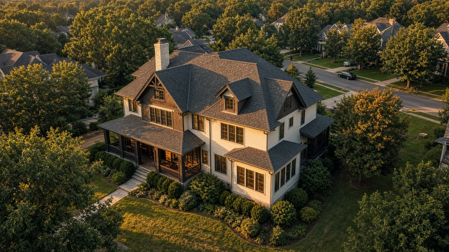
A drone can legally fly hundreds of feet above many properties, but that does not mean every listing photo should be taken from the top of the allowable range. For residential real estate, the strongest images usually come from several carefully chosen heights, each answering a different buyer question.
A low aerial view can make the home feel inviting and dimensional. A mid-height image can show the lot, roofline, driveway, and outdoor spaces. A higher context image can explain where the property sits in relation to nearby roads, water, woods, or neighborhood features. The goal is not maximum altitude. The goal is useful perspective.
Start With the Story the Property Needs to Tell
Before choosing a flight height, decide what the image needs to communicate.
For a typical suburban home, buyers usually want to understand the front elevation, roof shape, backyard, lot layout, driveway, and nearby homes. For a rural property, acreage boundaries, outbuildings, tree lines, and access roads may matter more. For a waterfront property, the relationship between the house, shoreline, dock, and open water can be the main selling point.
This is why one fixed altitude rarely produces a complete gallery. A residential drone shoot works better as a sequence of visual layers.
Low Aerials: Roughly 20 to 50 Feet
Low aerials are often the most flattering images of the house itself. At this range, the camera can rise above cars, hedges, fences, and neighboring visual clutter while keeping the home large enough in the frame to show architectural details.
These shots are useful for:
- A front three-quarter hero image
- A rear view showing the deck, patio, or pool
- A side angle that reveals depth and roofline
- A builder-completion photo that still feels architectural
At lower heights, small changes in position matter. Moving ten feet left or right can separate roof peaks, reveal a porch, or prevent a tree from blocking the entry. The pilot should work slowly and avoid treating the drone like a camera on an elevator.
Low aerials also require careful obstacle awareness. Trees, utility lines, flagpoles, antennas, and roof edges can be difficult to judge on a screen. The remote pilot must keep the aircraft within visual line of sight and avoid creating a hazard to people or property.
Mid-Height Views: Roughly 50 to 100 Feet
For many homes, the most informative listing images are made between about 50 and 100 feet. This range often shows the entire house, a meaningful portion of the lot, the driveway, landscaping, and key outdoor features without shrinking the property into a small object.
Mid-height views are useful for:
- Showing how the house sits on the lot
- Connecting the front and back outdoor spaces
- Showing a pool, detached garage, barn, or workshop
- Documenting residential construction progress
- Explaining a corner lot or unusual driveway arrangement
This range is also flexible enough to create both angled views and near-overhead images. A slightly downward camera angle generally feels more natural for marketing than a straight-down map-style shot. A true top-down image can still be useful when the lot shape, roof layout, or placement of improvements is important.
Higher Context Views: Roughly 100 to 200 Feet
Higher shots should have a clear purpose. They can show neighborhood context, nearby amenities, a long driveway, surrounding acreage, or a relationship to water and open land. They are less useful when they make the home too small to recognize.
A good context image answers a question such as:
- How close is the home to the lake?
- How private is the backyard?
- Where does the detached building sit?
- What surrounds the property?
- How does the subdivision connect to nearby roads?
One or two strong context images are usually more useful than a large set of similar high-altitude photos. Buyers do not need ten versions of the same distant view.
Why 400 Feet Is Not a Recommended Shooting Height
The FAA commonly limits small-drone operations to 400 feet above ground level, with specific provisions for flights near structures under Part 107. That is a regulatory ceiling in many situations, not a creative recommendation.
At 400 feet, an ordinary house may occupy only a small portion of the frame. Architectural detail disappears, neighboring properties dominate, and the image may communicate less than a carefully composed shot at one-quarter of that height.
Airspace can also impose lower authorized altitudes, especially near airports. Pilots should check current airspace conditions before every operation and obtain authorization when required. FAA-approved B4UFLY service providers and LAANC tools can help identify controlled airspace, restrictions, and authorized altitude limits.
Match Height to Property Type
Standard Neighborhood Home
Use lower front and rear architectural angles, then add mid-height lot views. A single higher neighborhood-context image may be enough.
Large Rural or Acreage Property
Use mid-height views for the home and improvements, then higher context images for fields, tree lines, access, and outbuildings. Avoid implying exact property boundaries unless a separately verified overlay is used and clearly labeled as approximate when appropriate.
Waterfront Home
Begin with low and mid-height views that keep the house, shoreline, and dock connected. Add a wider image showing the property’s relationship to the body of water. Avoid flying so high that the home becomes visually insignificant.
Home With a Pool or Outdoor Living Area
A rear three-quarter view at low or mid height often works best. It can show the pool, patio, yard, and rear architecture in one image. A top-down image may help explain the layout but should not replace the more inviting angled view.
New Construction
Repeatable mid-height positions are useful for progress documentation. For marketing the completed home, lower angles usually create a stronger finished-product presentation.
Camera Angle Matters as Much as Altitude
Two photos taken at the same height can look completely different depending on camera tilt and distance from the house.
A shallow downward angle keeps the horizon and gives the image a more cinematic, property-focused feel. A steeper angle emphasizes the lot and roof. A straight-down view functions more like a diagram.
The pilot should also avoid extreme wide-angle distortion. Flying farther back and using moderate framing can keep walls and rooflines looking more natural than hovering very close with an aggressively wide field of view.
Safety and Legal Checks Come First
Commercial real-estate photography generally falls under FAA Part 107. The remote pilot should hold the required certificate, register the aircraft as required, comply with Remote ID rules when applicable, keep the drone within visual line of sight, avoid careless or reckless operation, and follow restrictions on operations over people and moving vehicles.
Controlled airspace requires authorization. Temporary Flight Restrictions and other airspace limits can also affect a property shoot. Weather, wind, visibility, people on the site, neighboring activity, and obstacles may require a planned shot to be changed or skipped.
A homeowner or agent should expect a professional pilot to make those decisions. A safe substitute angle is better than forcing a planned shot.
A Practical Residential Shot-Height Plan
A simple starting plan for many homes is:
- Low front three-quarter view
- Low rear three-quarter view
- Mid-height front lot view
- Mid-height backyard and outdoor-living view
- Mid-height side or driveway view
- One higher context view when it adds useful information
- Optional top-down image for layout
The exact heights should change with the property. Trees, slope, home size, lot depth, neighboring structures, airspace limits, and the feature being highlighted all affect the final position.
The Best Height Is the Lowest One That Clearly Shows the Feature
That principle keeps the home important in the frame. It also encourages the photographer to create purposeful images rather than simply climbing until everything fits.
For sellers and Realtors, the most useful question is not, “How high can the drone fly?” It is, “What does the buyer need to understand from this image?” Once that is clear, the right height is usually easier to find.
Frequently Asked Questions
What is the best drone height for a front photo of a house?
Often, a low aerial position around 20 to 50 feet produces a strong front three-quarter view. The exact height depends on trees, roofline, lot slope, and nearby obstacles.
Should every listing include a 400-foot drone photo?
No. Four hundred feet is a common regulatory limit in applicable airspace, not a required or generally ideal photo height. Many homes look more useful and attractive from much lower positions.
What height works best for showing the full lot?
Mid-height or higher context views may work best, depending on lot size. For a standard residential lot, roughly 50 to 100 feet may be enough. Larger acreage may require higher views, subject to airspace and operating rules.
Are straight-down drone photos useful for real estate?
They can be useful for showing roof layout, lot arrangement, pools, driveways, and outbuildings. They work best as supporting images rather than the primary hero photo.
Can a drone photographer fly near an airport for a home listing?
Potentially, but controlled airspace generally requires FAA authorization. The pilot must check current airspace and follow the authorized altitude and any applicable restrictions.
Source Notes
Federal Aviation Administration, Small Unmanned Aircraft Systems Regulations (Part 107), updated July 6, 2026:
https://www.faa.gov/newsroom/small-unmanned-aircraft-systems-uas-regulations-part-107
Federal Aviation Administration, Certificated Remote Pilots including Commercial Operators:
https://www.faa.gov/uas/commercial_operators
Federal Aviation Administration, Getting Started / airspace and B4UFLY guidance:
https://www.faa.gov/uas/getting_started
Federal Aviation Administration, Remote Identification of Drones:
https://www.faa.gov/uas/getting_started/remote_id
National Association of REALTORS, REALTOR Technology Survey:
https://www.nar.realtor/research-and-statistics/research-reports/realtor-technology-survey