 By Bobby Rahm · August 8, 2026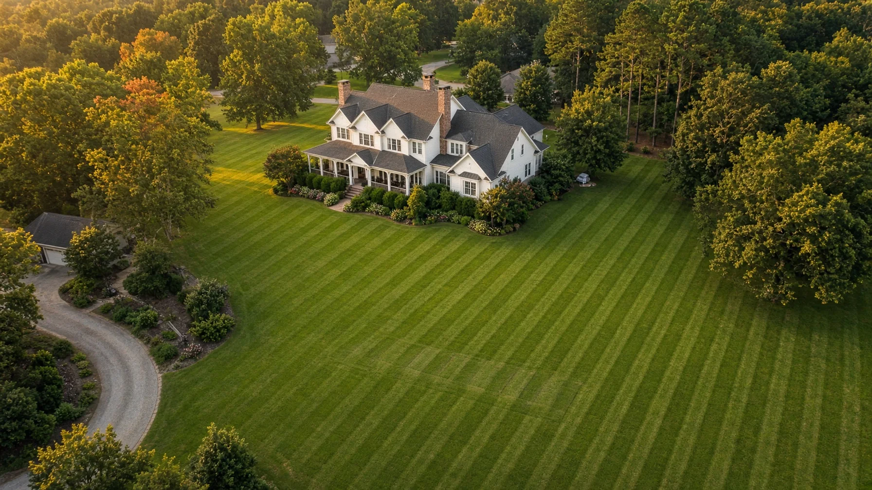
A septic system is mostly out of sight. That is exactly why good property documentation can become valuable later.
The tank, distribution components, piping, and much of the drainfield are buried. Homeowners may know the general area where the system sits but still have trouble showing a septic contractor, buyer, landscaper, fence installer, pool contractor, or future owner how the system relates to the rest of the property.
Drone photography can help with that larger visual context. A carefully planned aerial set can show the home, driveway, yard, visible access lids or risers, likely service approach, wells, slopes, drainage features, large trees, fences, outbuildings, and planned project areas in the same frame.
But there is an important limit: a drone photo is documentation, not subsurface detection. It cannot prove the exact location of buried septic components, determine whether the system is functioning properly, establish legal setbacks, identify soil suitability, or replace a professional inspection or the official system records.
That distinction is what makes the photos useful instead of misleading.
Start with the septic records, not the drone
The best septic documentation package combines official records with current photographs.
The U.S. Environmental Protection Agency says homeowners can typically contact their local permitting authority, such as a health or environmental department, to request the septic record drawing or as-built design and permit information for the property. Those records may include installation details and other system information.
If you have the as-built drawing, permit, pumping records, inspection reports, or contractor notes, gather them before the photo session. The aerial images can then serve as a current visual companion to those documents.
If you do not have records, do not use an aerial photo to guess where buried components must be. A septic professional may need to locate and inspect the system using appropriate methods.
What an aerial view can document well
A ground photo is good at showing a lid, riser, cleanout, wet spot, or damaged patch of turf. An aerial image is better at showing how those visible features relate to the whole lot.
For a typical residential property, useful context can include:
- the house and the side of the home where the building sewer exits, when known;
- visible septic tank risers, access lids, inspection ports, or control panels;
- the general drainfield area when its location is already known from records or a professional;
- driveway and service-vehicle access;
- fences, gates, retaining walls, sheds, garages, pools, decks, and other improvements;
- private wells and visible wellheads;
- major slopes, low areas, swales, ditches, or places where water visibly collects;
- large trees and established landscaping near the known system area;
- open yard areas that may be considered for future projects.
EPA explains that a conventional septic system commonly includes a septic tank and a drainfield, where wastewater is treated and dispersed through soil. That means the space around the drainfield matters. EPA homeowner guidance also recommends protecting the drainfield from vehicle traffic, excessive surface water, and inappropriate planting.
Aerial documentation can make those relationships easier to understand at a glance.
The most useful shot list
A good septic-property set does not need dozens of random overhead photos. A small, repeatable group of views is usually more useful.
1. Straight-down property overview
Capture a high, straight-down image showing the home, driveway, yard, and known septic area in one frame when possible. This becomes the reference image for the rest of the set.
If the property is too large for one useful frame, capture overlapping sections rather than flying so high that important features become tiny.
2. Angled overview from the house toward the system area
An oblique image makes elevation changes, tree lines, fences, retaining walls, and access routes easier to understand than a straight-down image alone.
3. Reverse angle from the system area toward the house
This helps document the relationship in both directions and can be useful when a contractor is trying to understand equipment access or the surrounding yard.
4. Known drainfield context
If the drainfield location has been established through records or a professional, photograph the full area and enough surrounding property to show nearby driveways, trees, structures, wells, slopes, and future project zones.
Do not label an uncertain patch of grass as the drainfield simply because it looks different from the rest of the yard.
5. Visible access points
Take ground-level photos of risers, lids, panels, cleanouts, or other known features, then include one aerial image that shows where those features sit relative to the house and driveway.
The ground and aerial views work better together than either one alone.
6. Service access
Document gates, driveway width, tight turns, overhead tree canopy, retaining walls, soft ground, and other visible conditions that may matter when a septic service vehicle needs access.
The image should document conditions, not claim that a particular truck can or cannot reach the tank. The contractor should make that determination.
Before landscaping, fencing, pools, additions, or driveway work
One of the best times to update the aerial record is before a major yard project.
EPA advises homeowners to protect the drainfield and keep heavy vehicles and structures away from it. Local rules and site-specific requirements vary, so homeowners should rely on local permitting authorities and qualified professionals for actual setback and construction decisions.
Before work begins, a photo set can document the current yard and known septic context. That can be useful when planning:
- a fence or gate;
- a pool or spa;
- a detached garage or shed;
- a home addition;
- a new driveway or parking pad;
- substantial grading or drainage work;
- tree removal or major landscaping;
- solar, utility, or irrigation work that crosses the yard.
The drone image does not approve the project. It gives the homeowner and the professionals involved a common visual reference.
Private wells deserve special attention
Homes with septic systems often also have private wells. EPA notes that improperly functioning septic systems or systems located too close to a drinking-water well can create contamination concerns.
If the property has a visible wellhead, include it in the aerial documentation when practical. That does not establish whether the well and septic system meet required separation distances. Those distances should come from permits, local rules, surveys, or qualified professionals.
The value of the photo is simply that it shows where visible features sit in relation to one another on the current property.
Photograph visible warning signs, then call the right professional
EPA lists warning signs of septic-system problems that can include slow drains, plumbing backups, sewage odors, standing water or damp areas near the tank or drainfield, and unusually lush or spongy grass over the system area.
If a homeowner sees something concerning from the ground or air, the next step is not more drone analysis. It is professional evaluation.
Aerial photos can document the extent of a visible wet area or show where it sits relative to the house and yard. They cannot determine why the condition exists or whether wastewater is reaching the surface.
If sewage is present, avoid contact and follow local health-department or environmental-agency guidance.
Use repeatable photos for a long-term property record
The most useful documentation is often the set you can compare later.
If you photograph the property again after pumping, repair work, landscaping, a home sale, a major storm, or construction, try to repeat the same basic camera positions and angles. Consistent images make changes easier to see.
A simple folder can include:
- the as-built or septic permit drawing;
- recent inspection and pumping records;
- the date of each aerial photo set;
- ground photos of known lids, risers, control panels, or other visible components;
- a straight-down overview;
- several matching oblique views;
- notes identifying which features were confirmed by records or a professional.
Avoid adding precise labels to uncertain features. A clean unlabeled photo is more useful than a confidently wrong annotation.
What drone photography cannot replace
This is the most important part of the guide.
Drone photos do not replace:
- a septic inspection;
- a tank or drainfield location performed by a qualified professional;
- an as-built drawing or permit record;
- soil evaluation;
- a boundary or topographic survey;
- engineering or drainage analysis;
- local health-department approval;
- code or setback verification.
EPA recommends regular septic inspections and points homeowners to local permitting authorities for system records. A professional inspection may involve opening tanks, reviewing records, evaluating system condition, and checking components that are completely invisible from the air.
Use the drone as a documentation tool around that process, not as a substitute for it.
Hiring a drone photographer for septic-property documentation
When you hire someone to capture images for a property-related purpose, the flight is generally a non-recreational operation. FAA Part 107 rules govern most small-drone work and business operations in the United States.
A qualified operator should evaluate the airspace, property layout, people and vehicles on site, weather, obstacles, and the safest takeoff and landing area. Controlled airspace may require FAA authorization. Drones that are required to be registered must also comply with applicable Remote ID rules.
For the homeowner, the more important planning question is what the final image set should accomplish. Tell the photographer that the goal is property documentation, not septic diagnosis. Provide the known system records before the flight when possible, and identify any features that have already been confirmed by a septic professional.
A simple homeowner checklist
Before the flight:
- Gather septic permits, as-built drawings, pumping records, and inspection reports.
- Identify only the septic features you actually know.
- Note the visible wellhead, driveway, gates, and planned project areas.
- Tell the photographer about pets, people, power lines, trees, or other site concerns.
During the flight:
- Capture one broad overhead reference image.
- Capture several oblique views from different sides.
- Include the house, known system area, access route, well, and major yard features when practical.
- Add ground photos of visible septic components.
After the flight:
- Store the images with the official system records.
- Add the date and basic notes.
- Do not label uncertain underground features as confirmed locations.
- Update the set after major property or septic work.
Frequently Asked Questions
Can a drone locate my buried septic tank?
No. A standard aerial photo cannot confirm the exact location of a buried septic tank, distribution box, piping, or drainfield. Start with permit/as-built records and use a qualified septic professional when components need to be located.
Can drone photos replace a septic inspection when I buy or sell a home?
No. Aerial photos can supplement the property record, but they do not evaluate tank condition, sludge levels, piping, distribution components, drainfield performance, or regulatory compliance. EPA describes professional inspection as a separate process that includes records review and physical system evaluation.
What should I photograph if I already know where the drainfield is?
Capture the full known area plus enough surrounding property to show the house, driveway, well, large trees, fences, slopes, structures, and planned project areas. Keep documentation labels tied to confirmed records or professional findings.
Are drone photos useful before a fence, pool, addition, or landscaping project?
Yes, as visual documentation. They can show current property relationships and provide a common reference for contractors. They do not establish legal setbacks or determine whether the project is permitted.
How often should I update the aerial record?
There is no required drone-photo schedule. Update it when the property changes enough that the old images no longer represent current conditions—for example after septic work, major landscaping, new structures, driveway changes, or before a sale.
SOURCE NOTES
- U.S. EPA — Frequent Questions on Septic Systems: https://www.epa.gov/septic/frequent-questions-septic-systems
- U.S. EPA — How Septic Systems Work: https://www.epa.gov/septic/how-septic-systems-work
- U.S. EPA — How to Care for Your Septic System: https://www.epa.gov/septic/how-care-your-septic-system
- U.S. EPA — SepticSmart: https://www.epa.gov/septic/septicsmart
- U.S. EPA — Resolving Septic System Malfunctions: https://www.epa.gov/septic/resolving-septic-system-malfunctions
- U.S. EPA — Septic Systems and Drinking Water: https://www.epa.gov/septic/septic-systems-and-drinking-water
- FAA — Small Unmanned Aircraft Systems Regulations (Part 107): https://www.faa.gov/newsroom/small-unmanned-aircraft-systems-uas-regulations-part-107
- FAA — Certificated Remote Pilots including Commercial Operators: https://www.faa.gov/uas/commercial_operators
- FAA — Remote Identification of Drones: https://www.faa.gov/uas/getting_started/remote_id