 By Bobby Rahm · August 8, 2026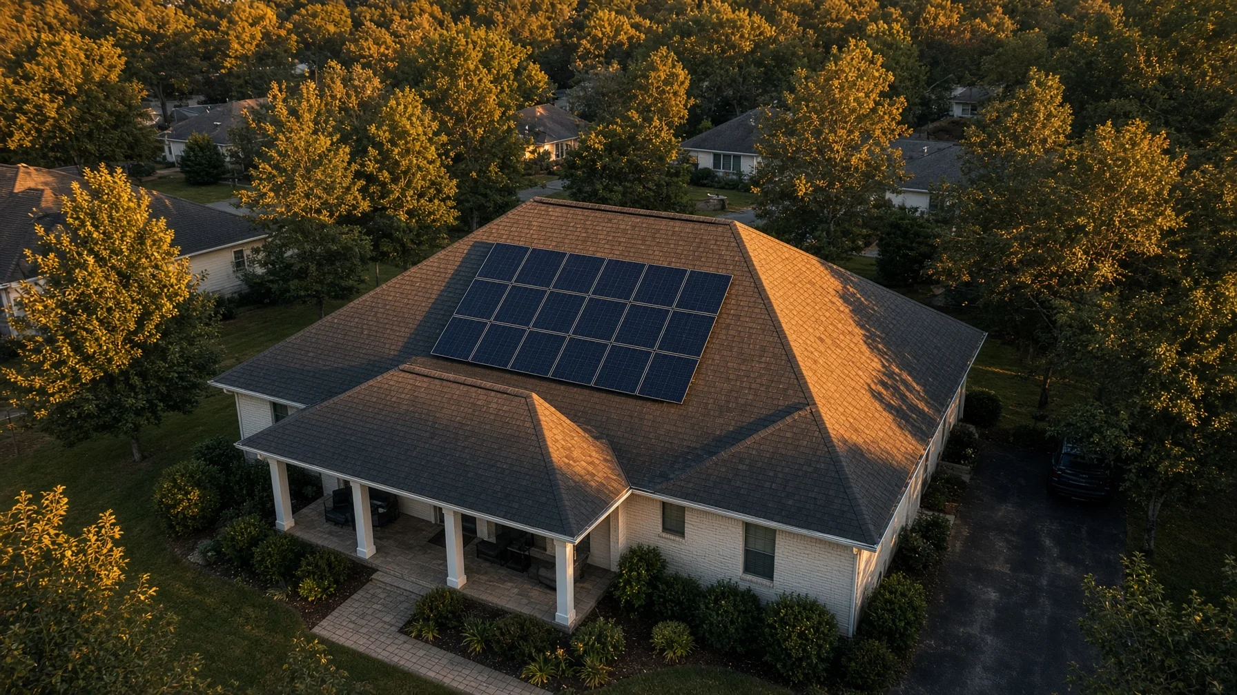
A rooftop-solar project changes one of the most important exterior surfaces on a home. Panels, rails, flashing, conduit, roof penetrations, setbacks, electrical equipment, and access paths all become part of a finished system that can be difficult to photograph clearly from the ground.
That makes drone photography useful, but only when it has a specific job. Aerial photos can create a visual record, help a homeowner understand the layout, show how work progressed, support conversations with an installer, and provide strong before-and-after images for a future home sale. They are not a substitute for engineering, permitting, electrical inspection, roof inspection, or code approval.
The U.S. Department of Energy notes that rooftop solar generally involves local permitting and a post-installation inspection before the system is allowed to operate on the grid. The drone-photo record should be treated as documentation that sits alongside those formal processes, not as a replacement for them.
Before installation: document the roof and property as they actually look
The most valuable solar photos are often the ones taken before a crew arrives.
Start with a complete set of overhead and angled views of every roof plane. Capture enough distance to show the relationship between roof sections, ridges, valleys, chimneys, plumbing vents, skylights, dormers, gutters, satellite equipment, nearby trees, and adjacent structures. Then add closer angled views of the roof surfaces that are expected to receive panels.
A useful pre-installation set should include:
- A straight-down image of the full roof when airspace and site conditions allow it.
- Four-corner oblique views showing the home from different directions.
- Closer views of the planned solar roof planes.
- Existing roof penetrations, vents, skylights, antennas, and other obstructions.
- Visible roof wear, damaged shingles, staining, missing material, or prior repairs that can be seen from the air.
- Gutters, fascia, roof edges, valleys, and drainage areas near the planned work.
- Trees or structures that visibly cast shade on the roof at the time of the flight.
- A wider property view showing driveway access, staging areas, and where ladders or equipment may reasonably be positioned.
The purpose is not to diagnose the roof from the sky. It is to preserve a dated visual baseline. If a question comes up later about whether a visible condition existed before the installation, a clear pre-project image set is much more useful than trying to reconstruct the answer from memory.
Do not turn an aerial photo into a structural or electrical conclusion
A high-resolution image can show a lot, but it cannot tell you everything.
Drone photos cannot confirm whether roof decking is structurally adequate, whether flashing was installed to the manufacturer’s requirements, whether fasteners are properly torqued, whether an electrical connection is safe, or whether a system complies with the adopted building, fire, and electrical codes in a particular jurisdiction.
DOE guidance emphasizes that rooftop-solar projects are subject to permitting and inspection requirements that vary by local government. NREL training materials for residential rooftop PV inspections likewise focus on plan review, structural, electrical, fire, and safety considerations that require more than an aerial image.
So use the photos for what they are good at: visible condition, layout, progress, context, and documentation.
During installation: photograph the stages that will disappear
Once the panels are installed, some of the most useful visual information may be hidden.
If the installer, homeowner, site conditions, and flight rules allow a progress flight, schedule it when meaningful portions of the mounting or wiring work are visible but before everything is covered by finished panels.
Useful progress images may include:
- Mounting rails before the panels cover them.
- Visible flashing or attachment locations that can be photographed safely without claiming they were installed correctly.
- Conduit routes along the roof or exterior wall.
- Junction boxes or exterior equipment locations that are visible from outside.
- Panel rows as installation progresses.
- Roof areas that remain intentionally clear around vents, skylights, ridges, or other features.
- Exterior paths between the roof array and visible electrical equipment.
This is especially useful when a homeowner cannot safely see the work from the ground. A single organized aerial set can make the project easier to understand than dozens of disconnected phone photos.
Ask the installer before flying while crews are working. A drone should never become another hazard above people on the roof or ground. Under FAA Part 107, operations over people are subject to specific requirements, and a remote pilot must avoid careless or reckless operation. In many residential jobs, the simplest and safest choice is to fly when workers are off the roof or positioned away from the flight path.
After installation: capture the finished layout clearly
The final photo set should be more than one dramatic overhead shot.
Begin with a full-roof image showing the complete array in context. Then capture oblique angles that show how the panels sit on the different roof planes and how the system relates to chimneys, skylights, roof edges, nearby trees, and the rest of the home.
A strong final set usually includes:
- Full property overview.
- Straight-down or near-overhead roof view.
- Front-left and front-right oblique views.
- Rear-left and rear-right oblique views.
- Closer array images from each relevant roof plane.
- Visible conduit and exterior equipment routes.
- A matching before-and-after angle when possible.
Matching the pre-installation and post-installation camera angles makes the visual record much easier to compare later.
What homeowners should ask the drone photographer to deliver
A residential solar documentation job does not need to become a complicated mapping project. What matters is consistency and organization.
Ask for:
- Full-resolution original JPEG images.
- A clearly labeled before, progress, and after folder structure.
- Capture dates retained in the file metadata.
- A small set of edited presentation images in addition to the documentary originals.
- Consistent naming such as
before-roof-east-01.jpgandafter-roof-east-01.jpg. - At least one wide property image for context.
- At least one close view of each panel-bearing roof plane.
If the homeowner may later use the images for a sale, warranty discussion, insurance file, or maintenance record, keep the original files rather than only resized social-media copies.
Solar marketing photos and documentation photos are not the same thing
The best image for a listing is not always the best image for a project file.
Marketing photos should make the home look attractive. They may use lower oblique angles, cleaner compositions, warm light, and wider views that show the home in context.
Documentation photos should prioritize repeatability and visible detail. They may be less dramatic but more useful for comparison.
For a homeowner planning to sell later, keep both. A polished hero image can show that the home has rooftop solar, while the documentary set preserves the detailed record.
Airspace and legal flight planning still matter over your own home
Owning the property does not give a drone pilot control of the airspace above it.
When a pilot is being paid or the flight is otherwise conducted for business purposes, FAA Part 107 rules generally apply. FAA guidance says Part 107 pilots must hold the appropriate remote pilot certificate, and controlled-airspace flights may require authorization. The FAA’s LAANC system can provide airspace authorizations in many locations near airports.
Drones that must be registered generally must also comply with Remote ID. Under Part 107, each drone used in the operation is registered individually. Site planning should also account for people, moving vehicles, obstacles, temporary flight restrictions, and any local rules governing where a pilot can take off or land.
A homeowner should not assume a flight is legal simply because the roof is private property.
When should the three flights happen?
For the cleanest record, think in three stages.
Before: after the project scope is settled but before panels, rails, or construction materials appear on the roof.
During: when meaningful attachment, rail, conduit, or panel-layout work is visible and the site can be flown safely without interfering with the crew.
After: once exterior work is complete, debris and temporary equipment are removed, and the finished system can be photographed clearly.
Not every project needs all three. A simple installation may only need a thorough before-and-after set. A complicated roof, major reroof, solar-plus-roofing project, or new home may benefit much more from a progress flight.
A simple homeowner shot list
If you want a short checklist to hand to a photographer, use this:
Before installation
- Full property overview
- Full roof overhead
- Each planned solar roof plane
- Vents, skylights, chimneys, valleys, gutters, and roof edges
- Visible pre-existing roof conditions
- Trees and structures near the array area
During installation
- Rail and attachment layout where visible
- Conduit routes
- Panel rows in progress
- Roof areas intentionally left clear
- Wide shot showing the overall work stage
After installation
- Full roof overhead
- Four oblique corner views
- Close view of every array plane
- Visible exterior equipment and conduit
- Matching before/after views
- One polished hero image of the completed home
The value is in the record, not just the picture
Aerial photography is most useful on a solar project when it answers a future question: What did the roof look like before? Where were the panels placed? How did the installation progress? What does the finished system look like from above? What should a future contractor, buyer, or homeowner be able to see without climbing onto the roof?
That is a different goal from simply getting a pretty drone shot.
Use the drone to create a clear visual history of the project, keep the images organized with the permit, inspection, warranty, and installer records, and leave the technical conclusions to the qualified professionals responsible for the roof, electrical system, solar equipment, and local code inspection.
Frequently Asked Questions
Can drone photos replace a solar inspection?
No. Drone photos can document visible conditions and layout, but they do not replace required building or electrical inspections, engineering review, installer commissioning, or other local approval processes.
Should I get drone photos before the solar panels are installed?
Yes, if you want a reliable visual baseline. Pre-installation images can document roof surfaces, existing penetrations, visible wear, nearby trees, and the overall roof layout before work begins.
Can a drone photograph the mounting hardware during installation?
Sometimes. A progress flight can photograph visible rails, attachments, conduit, and layout before panels cover portions of the work, but the flight should be coordinated with the installer and conducted without creating a hazard around workers.
Do I need permission from the FAA to fly over my own house?
Property ownership does not itself authorize a flight. Business flights generally fall under Part 107, and controlled airspace may require FAA authorization. Other operating rules also apply.
Are drone photos useful when selling a home with solar?
Yes. A polished aerial image can show the array in the context of the home and property, while the documentary set can help preserve a visual history for the homeowner’s records. The photos should not be presented as proof of system performance or code compliance.
Source Notes
- U.S. Department of Energy, Permitting and Inspection for Rooftop Solar: https://www.energy.gov/cmei/systems/permitting-and-inspection-rooftop-solar
- Federal Aviation Administration, Certificated Remote Pilots including Commercial Operators: https://www.faa.gov/uas/commercial_operators
- Federal Aviation Administration, Remote Identification of Drones: https://www.faa.gov/uas/getting_started/remote_id
- Federal Aviation Administration, How to Register Your Drone: https://www.faa.gov/uas/getting_started/register_drone
- Federal Aviation Administration, Part 107 Airspace Authorizations: https://www.faa.gov/uas/commercial_operators/part_107_airspace_authorizations
- Federal Aviation Administration, Operations Over People General Overview: https://www.faa.gov/uas/commercial_operators/operations_over_people
- National Renewable Energy Laboratory, Residential Rooftop PV Permitting and Field Inspection training overview: https://research-hub.nrel.gov/en/publications/chapter-1-introduction-to-residential-rooftop-pv-permitting-and-c/