 By Bobby Rahm · August 8, 2026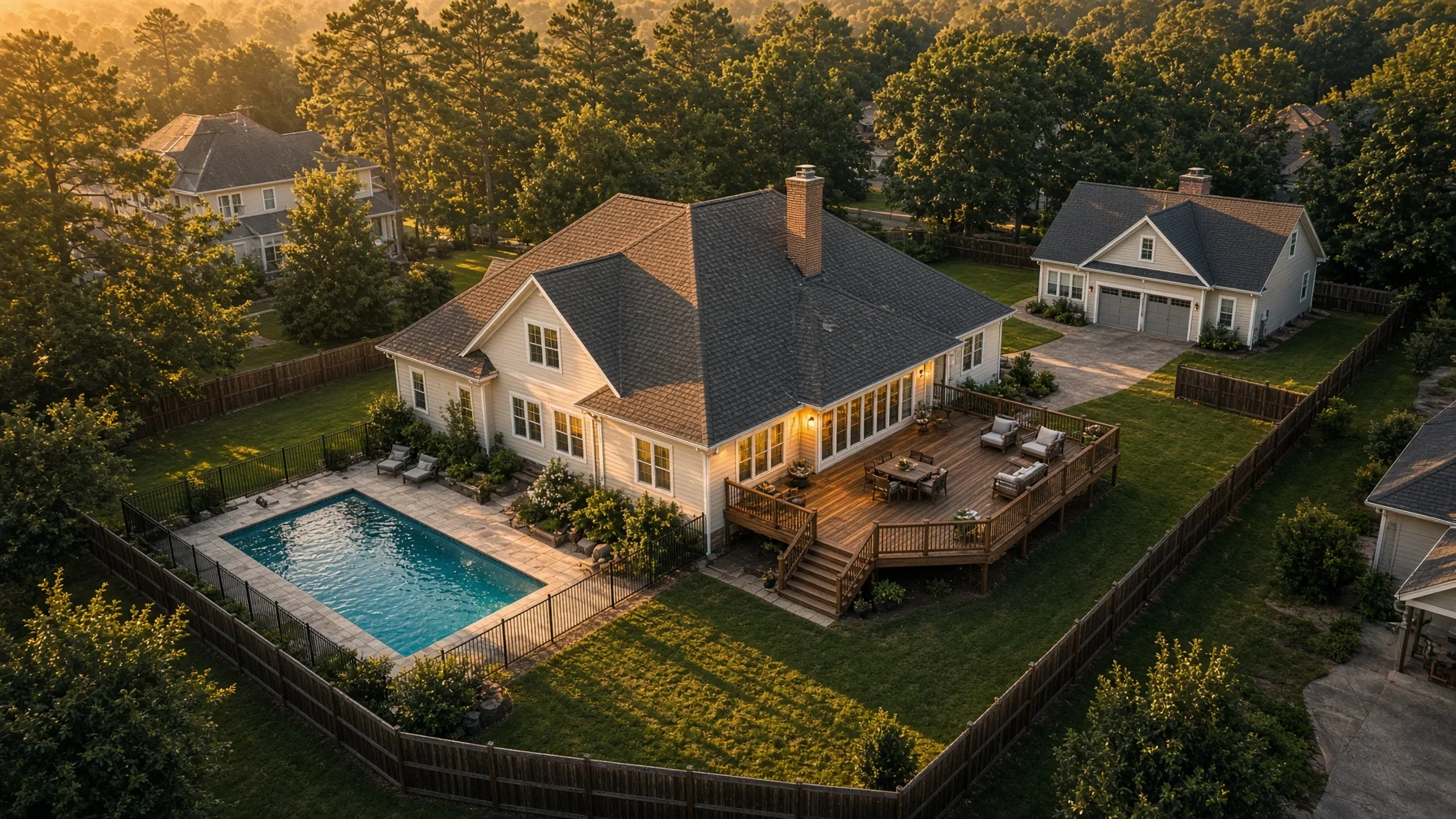
Most home inventories focus on what is inside the house: furniture, electronics, appliances, clothing, and valuables. That is important, but it leaves out a large part of the property. Roof surfaces, detached garages, sheds, fencing, pools, decks, solar panels, landscaping, and recent exterior improvements can be difficult to document completely from ground level.
A short, well-planned drone photo session can add an exterior layer to a homeowner’s records. The goal is not to prove that every future claim will be covered or to replace an adjuster’s inspection. The goal is simpler: create clear, dated images showing what was present and what condition it appeared to be in before a loss.
The National Association of Insurance Commissioners encourages consumers to maintain an accurate home inventory because it can help provide insurers with information needed to settle claims. Ready.gov also recommends documenting and insuring property as part of disaster preparedness. Drone images can support that larger record when they are organized carefully and stored securely.
What Drone Photos Can Add to a Home Inventory
Ground photos remain essential. They show serial numbers, finishes, close details, and indoor contents. Drone photos serve a different purpose. They provide context.
Aerial images can show how structures relate to one another, the approximate layout of the lot, the condition of broad roof areas, and the presence of improvements that are hard to capture in one frame from the ground. They may also help a homeowner remember features that would otherwise be overlooked after a damaging event.
Useful subjects include:
- The main house from all four sides
- Each major roof plane, including additions
- Detached garages, workshops, barns, sheds, and guest structures
- Decks, patios, porches, pergolas, and outdoor kitchens
- Pools, pool houses, hot tubs, and permanent recreation features
- Fences, gates, retaining walls, and long driveways
- Solar panels, satellite equipment, generators, and exterior HVAC units
- Mature trees, planted beds, irrigation features, and substantial landscaping
- Docks, seawalls, drainage features, and shoreline improvements where applicable
The value comes from complete coverage, not dramatic angles. A beautiful sunset image may be useful for marketing, but an insurance inventory benefits more from level, evenly exposed photographs with clear detail.
Start With a Simple Shot List
Before the flight, make a written list of every permanent exterior feature that matters. Walk the property from the ground and add anything that is easy to miss from above, such as a covered generator, a screened porch, a second shed behind trees, or a retaining wall at the edge of the lot.
A practical baseline shot list includes:
- One wide image showing the entire property from the front.
- One wide image from the rear.
- One image from each side.
- A near-vertical overhead image when airspace, trees, and safety conditions allow.
- Oblique roof images from several directions.
- Individual images of each detached structure.
- Separate images of expensive outdoor improvements.
- Ground-level close-ups of serial plates, model numbers, receipts, and fine damage-prone details.
The final item matters because drone photos should complement, not replace, close-range documentation.
Photograph the Roof Without Turning the Session Into an Inspection
Aerial roof photos can show missing materials, visible patchwork, broad staining, impact areas, flashing locations, vents, skylights, and the overall roof layout. They can also preserve a record after a replacement or major repair.
However, routine drone photography is not automatically a roof inspection, engineering evaluation, or statement about remaining service life. A photograph may reveal a visible condition without establishing its cause or severity. Keep the description factual: “north roof plane photographed on August 6” is better than “roof confirmed to be in perfect condition.”
For documentation purposes, ask for consistent angles, adequate overlap, and enough resolution to view major features. Avoid extreme wide-angle distortion that makes roof edges or slopes difficult to interpret.
Include Detached Structures and Outdoor Improvements
Many homeowners remember the house and forget the structures around it. A detached garage may contain substantial electrical work, finished interiors, storage systems, or specialized doors. A workshop may have exterior equipment. A pool area may include decking, fencing, pumps, heaters, lighting, and a pool house.
Capture each structure both in context and by itself. One wide image should show where it sits on the property. Additional images should show each visible side and the roof. For large improvements, keep copies of invoices, permits, contracts, and ground-level photos in the same digital folder.
The NAIC’s home-inventory guidance emphasizes recording belongings and keeping photographs. The same organizational principle applies outside: images are more useful when paired with dates, descriptions, receipts, and identifying details.
Use Repeatable Angles for Future Updates
A home inventory is not a one-time project. It should be updated after a roof replacement, addition, pool installation, major landscaping project, solar installation, fence replacement, or purchase of an expensive detached structure.
Repeatable angles make updates easier to compare. Ask the pilot to save a simple flight map or note the approximate launch point, altitude, camera direction, and key viewpoints. Exact survey-grade repetition is unnecessary for a homeowner inventory, but similar framing creates a much clearer before-and-after record.
A useful update schedule is:
- After any major exterior improvement
- After replacing the roof or siding
- After constructing or removing a detached structure
- After major tree removal or drainage work
- Once every few years when no major change has occurred
- Before an approaching seasonal risk only when there is adequate time and it can be done safely
Do not wait until severe weather is arriving. Drone flights should never be rushed in unsafe wind, lightning, smoke, restricted airspace, or emergency-response conditions.
Store the Files So They Can Actually Be Found
The best images are useless if they disappear with a damaged phone or computer. Store the complete inventory in at least two places, with one copy outside the home.
A simple folder structure might be:
Home Inventory
- Interior rooms
- Receipts and serial numbers
- Exterior ground photos
- Drone photos
- Renovation records
- Insurance policy and contact information
Rename files with dates and plain descriptions, such as 2026-08-06-north-roof.jpg or 2026-08-06-detached-garage-east-side.jpg. Keep the original full-resolution files. Export smaller copies only for convenient sharing.
Cloud storage can be useful, but access should be protected with a strong password and multifactor authentication. Avoid publicly posting a complete aerial inventory that reveals property layout, access points, equipment, or security features.
What to Ask a Drone Photographer
When hiring a professional, explain that the assignment is documentation rather than real-estate marketing. Ask for:
- Full-resolution original JPEG files
- Clear coverage of every requested structure and improvement
- Consistent, neutral editing without heavy sky replacement or object removal
- A date-stamped delivery folder or written capture date
- No artificial removal of roof marks, utility lines, fencing, or other property details
- Confirmation that the flight can be conducted legally and safely at the address
- A clear policy on image retention and deletion
A paid or business-purpose drone flight generally falls under the FAA’s Part 107 framework. The remote pilot should hold a current FAA Remote Pilot Certificate, use an appropriately registered aircraft, comply with Remote ID requirements when applicable, and obtain any needed controlled-airspace authorization. The FAA makes clear that operations not conducted purely for recreation require the appropriate Part 107 qualifications.
What Drone Photos Do Not Guarantee
Drone photos do not establish coverage, replacement cost, ownership, code compliance, legal property boundaries, structural soundness, or the cause of future damage. Policy terms, deductibles, exclusions, endorsements, depreciation, and state law still control how a claim is handled.
After damage occurs, follow the insurer’s instructions. The NAIC advises homeowners filing a claim to notify the insurer promptly, make a list of damaged property, and take photos and videos of damage. Preserve pre-loss images separately so they are not confused with post-loss documentation.
Do not enter unsafe areas or fly near emergency operations merely to obtain pictures. Life safety comes first.
A Practical Final Checklist
Before considering the exterior inventory complete, confirm that you have:
- Wide views of the entire property
- All sides of the main house
- Every major roof plane
- Each detached structure
- Pools, decks, fences, retaining walls, and other improvements
- Exterior mechanical and energy equipment
- Ground photos of serial numbers and receipts
- Original full-resolution files
- Clear filenames and capture dates
- At least one secure off-site backup
- A reminder to update the record after major changes
A drone is not necessary for every part of a home inventory, but it can fill the gaps that are hardest to document from the ground. Used carefully, it creates a clearer record of the property as a whole—and makes the rest of the inventory easier to understand when it matters most.
Frequently Asked Questions
Can drone photos prove that an insurance claim should be paid?
No. They can document visible pre-loss conditions and property features, but coverage depends on the policy, cause of loss, exclusions, deductibles, and the insurer’s claim evaluation.
Should I take the drone photos myself?
Only when the flight is legal, safe, and appropriate for your purpose. FAA rules distinguish purely recreational flying from non-recreational operations. Hiring a certificated Part 107 pilot is the clearest option when the images are being produced as a paid documentation service.
How often should exterior inventory photos be updated?
Update them after major changes such as a new roof, addition, pool, solar system, detached building, or substantial landscaping project. Periodic updates are also useful when the property has not changed significantly.
Are aerial photos enough for a complete home inventory?
No. Pair them with interior photos, receipts, serial numbers, policy records, ground-level close-ups, and written descriptions.
Should the files include visible timestamps?
A visible date stamp is optional and can cover image detail. A reliable capture date in the file metadata, delivery records, and filenames is usually more useful. Preserve original files so metadata is not lost.
SOURCE NOTES
- National Association of Insurance Commissioners, Home Inventory: https://content.naic.org/consumer/home-inventory
- National Association of Insurance Commissioners, What You Need to Know When Filing a Homeowners Claim: https://content.naic.org/article/what-you-need-know-when-filing-homeowners-claim
- Ready.gov, Document and Insure Your Property: https://www.ready.gov/collection/document-insure-property
- FAA, Become a Certificated Remote Pilot: https://www.faa.gov/uas/commercial_operators/become_a_drone_pilot
- FAA, Small Unmanned Aircraft Systems Regulations (Part 107): https://www.faa.gov/newsroom/small-unmanned-aircraft-systems-uas-regulations-part-107
- FAA, How to Register Your Drone: https://www.faa.gov/uas/getting_started/register_drone
- FAA, Remote Identification of Drones: https://www.faa.gov/uas/getting_started/remote_id
- FAA, UAS Data Exchange (LAANC): https://www.faa.gov/uas/getting_started/laanc