 By Bobby Rahm · August 9, 2026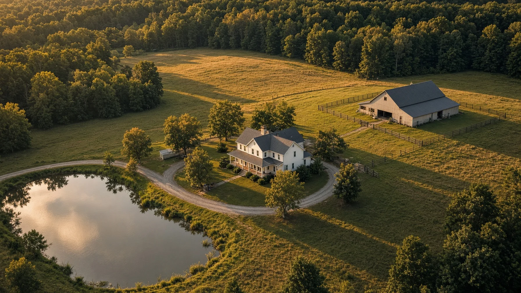
A standard suburban listing can often be understood from the street. A rural home is different. The driveway may curve through trees. The house may sit hundreds of feet from the road. A barn, pond, pasture, workshop, creek, guesthouse, or second entrance may be impossible to understand from ground-level photos alone.
That is where drone photography becomes especially useful. The goal is not simply to make the property look large. It is to help a buyer understand how the home, land, access, improvements, and surroundings fit together.
The best rural listing packages use a deliberate shot sequence. Each image should answer a question a serious buyer is likely to ask.
Start With the Story the Property Needs to Tell
Before the drone leaves the ground, decide what makes the property valuable and what may confuse buyers.
A five-acre home with a detached shop needs a different plan from a 40-acre property with pasture and timber. A lake home needs to show the relationship between the house, shoreline, dock, and road access. A horse property needs to show fencing, barns, gates, turnout areas, and the distance between them.
Create a short feature list before the shoot. Include:
- The house and immediate yard
- Driveways, gates, and road access
- Garages, barns, workshops, sheds, or guest buildings
- Ponds, creeks, shoreline, pasture, timber, trails, or gardens
- Fencing and major internal divisions
- Nearby features that add context, such as a lake, public road, or adjoining development
This keeps the flight focused. It also reduces the temptation to rely on one dramatic image that looks impressive but does not explain the property.
Shot 1: The Clear Primary Hero View
The hero image should identify the home immediately. It should not make the viewer search for the house in the middle of a giant landscape.
A useful hero view usually shows the front or best architectural angle of the home from a modest elevation. Include enough surrounding land to communicate privacy and setting, but keep the house visually dominant.
For wooded homes, a slightly lower oblique angle often works better than a straight-down image. For open acreage, a wider view can show the home, lawn, nearby improvements, and land extending beyond them.
The hero image should answer: What is being sold, and what does it feel like to arrive there?
Shot 2: The Full Property Layout
Next, provide a broad orientation image. This is the view that shows how the main features relate to one another.
Try to include the home, primary driveway, major outbuildings, and the most important land feature in a single frame. The image may be higher and wider than the hero shot, but it still needs recognizable landmarks.
This view is particularly helpful when the property has:
- Multiple structures
- A long or shared driveway
- Separate pasture areas
- A pond behind the house
- A workshop away from the residence
- More than one entrance
A buyer should be able to look at the image and understand the basic arrangement without consulting a map.
Shot 3: Road Access and the Arrival Sequence
Access matters more on rural properties than many listing packages acknowledge. Buyers want to know whether the home is close to the road, hidden from it, approached by a long drive, or served by a shared entrance.
Capture one view looking from the road toward the property and another looking back toward the road when useful. Show the driveway surface, gate, bridge, culvert, turn, or tree-lined approach if those features matter.
Do not use an angle that makes a private drive appear public or conceals a neighboring entrance. Clear context builds trust and reduces surprises during a showing.
Shot 4: The Home in Relation to the Land
A rural buyer is rarely purchasing only the structure. Show how the home sits within the usable portion of the property.
Good angles may reveal:
- The distance from the house to the barn or shop
- The relationship between the back porch and pond
- The amount of open lawn around the home
- The transition from pasture to timber
- The privacy buffer between the residence and the road
This image often performs better than an extreme-altitude shot because the features remain large enough to understand.
Shot 5: Outbuildings as Real Features, Not Background Objects
Barns, workshops, garages, equipment sheds, and guest structures deserve their own aerial coverage when they affect the property's value.
Capture an oblique image that shows the building's exterior and access. A second, wider image can show its position relative to the house and driveway. For a shop or detached garage, buyers may want to see whether a trailer can reach it and whether there is room to turn around.
Avoid implying a building's condition, permitted use, square footage, or utility service unless those details have been independently verified. Drone photos can show visible layout; they cannot confirm legal status or hidden condition.
Shot 6: Water Features With Useful Context
Ponds, creeks, rivers, and shoreline can be major selling points, but they should be photographed in a way that shows their real relationship to the home.
Useful images include:
- The house and water in the same frame
- The route from the home to the shoreline or pond
- A lower oblique view that shows the visible bank and surrounding terrain
- A wide view showing the water feature within the property setting
Do not use drone imagery to claim a flood zone, water depth, property ownership, navigability, or year-round water level. Those questions require appropriate records, surveys, maps, and professional verification. FEMA's official flood-map tools are a more appropriate source for mapped flood-hazard information than a listing photograph.
Shot 7: Pasture, Fencing, and Usable Open Ground
For horse properties, hobby farms, and homes with pasture, buyers need more than a green aerial rectangle.
Photograph gates, fence lines, barns, water locations, cross-fencing, and the route between the house and animal areas when visible. Use angles that show terrain and access rather than flattening everything into a straight-down image.
Aerial photos can help buyers understand visible land use, but they should not promise carrying capacity, soil quality, acreage, or agricultural suitability. USDA and local conservation resources may provide useful land information, but those records should remain separate from marketing imagery.
Shot 8: Timber, Trails, and Privacy Buffers
Wooded acreage can look like an undifferentiated canopy from high altitude. To make it useful, show where the woods begin, how they relate to the home, and whether visible trails or clearings connect major features.
A lower angled view can show the depth of a privacy buffer better than a straight-down frame. In leaf-off seasons, more ground detail may be visible, while full foliage may better communicate summer privacy. The right choice depends on the property's story and the accuracy of the representation.
Shot 9: Straight-Down Images Used Carefully
A straight-down or near-vertical image can clarify building placement, driveway geometry, gardens, pools, and visible land divisions. It is also useful as a base for a clearly labeled orientation graphic.
However, a vertical drone photo is not a survey. Do not draw definitive property lines from visual clues such as fences, tree lines, mowing patterns, roads, or utility clearings. If an overlay is included, label it as approximate unless it is based on reliable survey or GIS data, and explain the source.
Shot 10: Neighborhood and Destination Context
Rural does not always mean isolated. A final context image may show the property's relationship to a lake, mountain view, nearby town, major road, subdivision entrance, or surrounding countryside.
Keep the home or property identifiable, and avoid framing that exaggerates proximity. A wide-angle lens and compressed composition can make a destination appear closer than it is. Listing text should provide actual driving distance or travel time from a reliable mapping source rather than relying on visual suggestion.
Plan for Weather, Light, and Seasonal Conditions
Large properties are especially sensitive to weather and season. Wet drives, brown pasture, leafless woods, low water, haze, and long shadows can change how the land reads.
The ideal conditions depend on the feature being emphasized:
- Morning or late-afternoon light can add shape to terrain and buildings.
- Midday light may reduce long shadows over heavily wooded areas.
- Leaf-off conditions can reveal structures, trails, and topography.
- Full foliage can better show privacy and tree coverage.
- Calm conditions improve image sharpness and flight stability.
The goal is not to hide normal seasonal conditions. It is to choose a time that presents the property clearly and honestly.
Legal and Safety Points Sellers Should Know
Real-estate photography performed to help sell a property is a non-recreational drone operation. The FAA specifically identifies taking photos to help sell a property or service as non-recreational activity. In most routine cases, the operation falls under Part 107 and should be conducted by or under the direct supervision of an FAA-certificated remote pilot.
The operator must also evaluate airspace, maintain visual line of sight, comply with applicable altitude and operating rules, and obtain authorization when required in controlled airspace. The FAA's LAANC system can provide near-real-time airspace authorizations at participating airports, but approval and permitted altitude depend on the exact location.
Homeowners should not assume that owning the property creates unrestricted airspace above it. The pilot remains responsible for the flight, and local takeoff or landing restrictions, temporary flight restrictions, people, traffic, obstacles, and nearby airports may affect the plan.
A Practical Deliverable List
For most acreage listings, a useful final package includes:
- One strong hero image
- One broad layout image
- One road-access or arrival image
- Two or three feature-specific images
- One home-to-land relationship image
- One vertical orientation image when useful
- One surrounding-context image
That usually provides more value than delivering dozens of nearly identical high-altitude frames. Buyers need clarity, not repetition.
The Bottom Line
Drone photography is most valuable on rural listings when it explains the property rather than merely showing that it is large. A planned sequence can reveal access, layout, improvements, land use, privacy, and setting in a way ground photos cannot.
The strongest package is accurate, specific, and easy to follow. It highlights what makes the property special while leaving surveys, legal boundaries, flood determinations, building condition, and land suitability to the proper records and professionals.
FAQs
Do all acreage listings need drone photography?
No. Drone photography is most useful when ground photos cannot clearly show the layout, access, outbuildings, land features, privacy, or relationship between structures. A small, open property with a simple layout may need only a few aerial images.
How high should a drone fly for real-estate photos?
There is no single ideal height. Lower oblique views often explain buildings and terrain better, while higher images help with overall layout. The pilot must stay within applicable FAA limits and any authorized altitude for the location.
Can a Realtor add property lines to a drone photo?
An overlay can be useful, but it should not be presented as a survey unless it is based on authoritative data and accurately applied. Clearly disclose when boundaries are approximate and identify the source used.
Can the homeowner take the drone photos personally?
When the purpose is helping sell the property, the FAA treats the flight as non-recreational. The operation generally needs to comply with Part 107 requirements, even when no separate photography fee is charged.
What should be photographed first on a large property?
Start with the home and its immediate setting, then capture a broad layout view. After that, photograph access, outbuildings, water, pasture, woods, or other features that materially affect the property's value and use.
SOURCE NOTES
Federal Aviation Administration, Recreational Flyers & Community-Based Organizations — identifies real-estate sales photography as non-recreational and explains when Part 107 applies:
https://www.faa.gov/uas/recreational_flyersFederal Aviation Administration, Small Unmanned Aircraft Systems Regulations (Part 107) — operating framework, visual-line-of-sight, altitude, weather, and safety requirements:
https://www.faa.gov/newsroom/small-unmanned-aircraft-systems-uas-regulations-part-107Federal Aviation Administration, UAS Data Exchange (LAANC) — controlled-airspace authorization information and approved service suppliers:
https://www.faa.gov/uas/getting_started/laancNational Association of REALTORS®, 2025 REALTOR® Technology Survey — reports drone photography/video among commonly used real-estate technologies:
https://www.nar.realtor/research-and-statistics/research-reports/realtor-technology-surveyUSDA Farm Production and Conservation Business Center, Imagery Catalogs — official aerial-imagery resources and historical availability information:
https://www.fpacbc.usda.gov/geospatial-services/customer-services/imagery-catalogsFEMA Flood Map Service Center — official source for flood-hazard maps and related products:
https://msc.fema.gov/portal/home