 By Bobby Rahm · August 9, 2026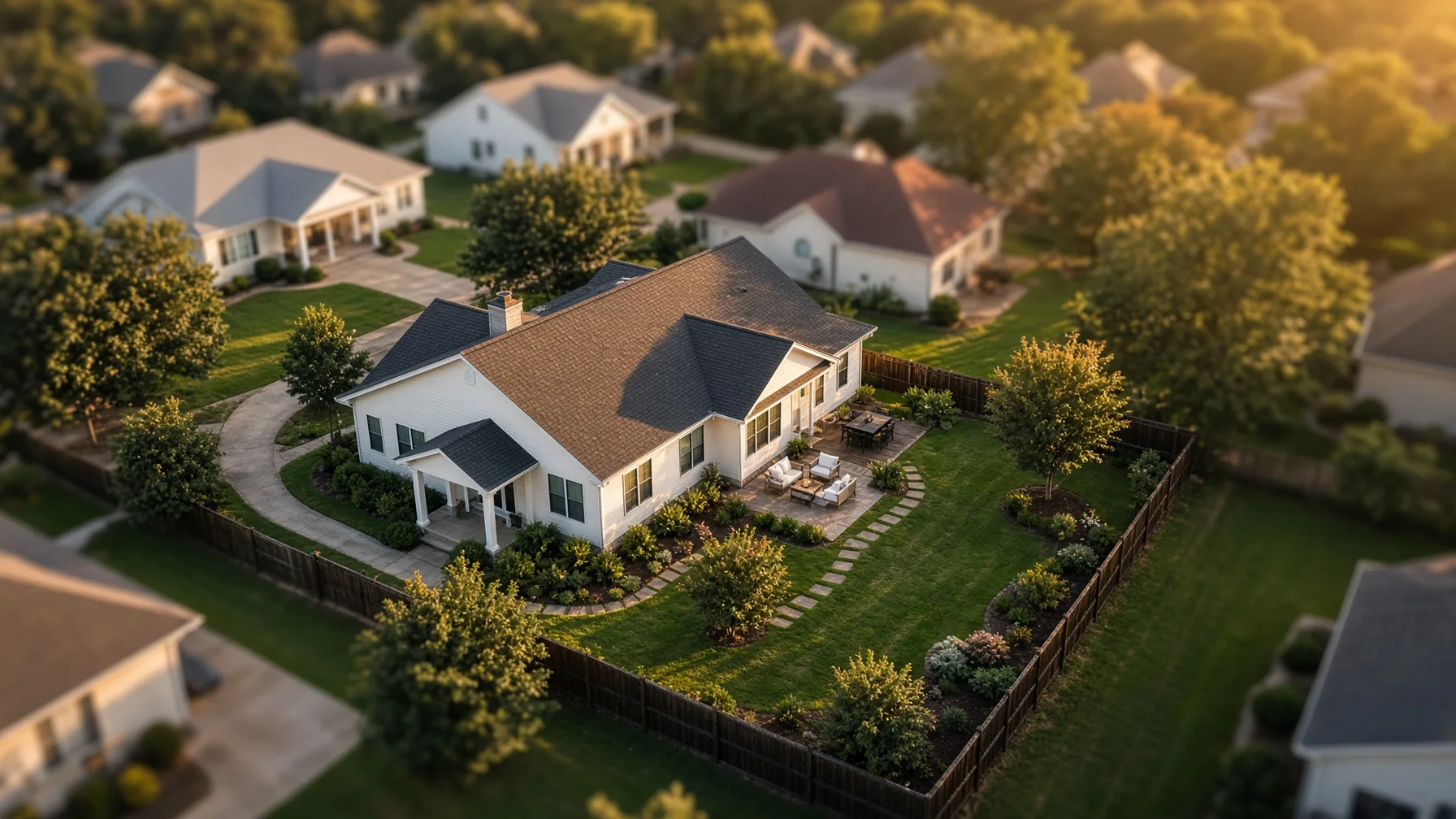
Aerial photos can make a home listing easier to understand. They can show the shape of the lot, the relationship between the house and driveway, the location of a detached garage, the scale of a backyard, or how close the property is to a lake, greenway, or neighborhood entrance.
The same camera angle can also capture more than a seller intended. A neighboring patio, fenced yard, swimming pool, open window, license plate, or person may appear in the frame. That does not automatically mean the flight was unlawful, but it can create a legitimate concern and an unnecessary dispute.
The best approach is simple: plan the flight around the home being marketed, collect only the imagery needed for the listing, and avoid treating nearby private spaces as background scenery.
The FAA Regulates Flight Safety, Not General Privacy
The Federal Aviation Administration regulates the national airspace and the safety of drone operations. It does not serve as the general privacy regulator for residential photography. The FAA specifically notes that local privacy laws may apply when a drone is flown over or near a home.
That distinction matters. A pilot can comply with federal flight rules and still create a problem through careless camera use, intrusive positioning, or poor judgment. Sellers and Realtors should therefore evaluate two separate questions:
- Can the flight be conducted safely and legally under applicable FAA rules?
- Can the desired images be captured without unnecessarily recording neighboring people or private areas?
A professional operator should be prepared to address both.
Commercial Listing Photography Falls Under Part 107
A drone flight performed to market a home is a business use, even when the seller is not directly paying the pilot. In most cases, the operator should be flying under the FAA’s Part 107 rules and should hold a Remote Pilot Certificate.
Part 107 flights must follow operating requirements that include avoiding manned aircraft, keeping the drone within visual line of sight, complying with airspace restrictions, and avoiding careless or reckless operations. Controlled airspace may require prior authorization.
Sellers do not need to become aviation experts, but they should ask the operator whether the flight will be conducted under Part 107 and whether the location requires airspace authorization.
Remote ID Does Not Give a Photographer Permission to Invade Privacy
Most registered drones must comply with Remote ID. Remote ID broadcasts identification and location information that can be received by nearby parties using compatible equipment.
Remote ID is an aviation accountability system. It does not create a right to photograph private activity, and it does not replace professional judgment. A compliant drone can still be flown in a way that makes neighbors uncomfortable. Good planning should reduce the chance that anyone feels watched or targeted.
Start With a Tight Shot List
Privacy problems often begin when the flight has no clear purpose. The pilot launches, circles the block, records long video clips, and decides later what might be useful. That approach collects far more imagery than the listing needs.
A better shot list usually includes a limited group of views:
- Front elevated view showing the home and lot approach
- Rear elevated view showing the backyard layout
- Oblique corner views showing the structure’s shape
- Straight-down or near-vertical view when lot context is important
- One or two wider neighborhood-context images when a nearby feature genuinely adds value
The pilot should know which direction to point the camera, how wide the frame needs to be, and what neighboring features should be excluded whenever practical.
Avoid Hovering Near Neighboring Windows and Yards
A drone does not need to hover beside a neighboring window to photograph a home listing. It also should not remain over a neighbor’s yard simply because that position creates a dramatic angle.
In many cases, the same marketing value can be achieved by:
- Flying from the seller’s property or another authorized launch point
- Using a higher, wider angle rather than a close side angle
- Positioning the camera toward the subject property
- Shortening the flight and limiting repeated passes
- Cropping the final image to reduce unnecessary neighboring detail
A pilot may need to reposition briefly for safe operation or composition, but the flight plan should remain centered on the listed property.
People and Moving Vehicles Require Extra Planning
Part 107 rules place restrictions on operations over people and moving vehicles. Some drones and operations may qualify under specific categories, but sellers should not assume that every commercial drone can routinely hover over neighbors, pedestrians, contractors, or traffic.
Scheduling can solve many problems. A photographer may choose a time when the driveway is clear, children are not playing nearby, landscaping crews have left, and street traffic is lighter. The goal is not only regulatory compliance. It is also to create a calm, controlled photo session.
Consider Giving Nearby Neighbors a Courtesy Notice
A courtesy notice is not always legally required, and the exact legal rules vary by location. Still, a simple heads-up can prevent confusion when homes are close together.
The notice can be brief:
“A licensed drone photographer will be taking listing photos of our property tomorrow between 10:00 and 10:30 a.m. The camera will be focused on our home and lot.”
This does not give the neighbor control over the seller’s listing, but it explains the purpose and timeframe. It also gives the photographer a chance to avoid a known concern, such as a neighbor working in the backyard during the planned flight.
Review the Images Before They Are Published
The raw photos may include details that should not appear in a public listing. Before publishing, the seller, Realtor, or editor should check for:
- Clearly identifiable people who are not part of the listing
- Neighboring children or private gatherings
- Open windows with visible interior activity
- Legible license plates
- Security-system details that add no marketing value
- Mail, packages, or documents visible from above
- Neighboring pools, patios, or yards shown more prominently than necessary
Cropping, selecting a different frame, or applying a limited blur can often solve the problem without weakening the listing.
Do Not Use Property-Line Graphics as Legal Proof
Aerial images are useful for orientation, but they are not a substitute for a survey. If a listing includes a property-line overlay, it should be clearly labeled as approximate unless it was prepared from reliable survey data and reviewed appropriately.
This is also a privacy issue. An inaccurate line can make it appear that a neighboring driveway, fence, shed, or yard belongs to the listed property. That can trigger disputes that have nothing to do with the drone flight itself.
Use aerial imagery to explain the property, not to make unsupported legal claims.
Choose a Photographer Who Can Explain the Plan
A prepared residential drone photographer should be able to answer practical questions before launch:
- Are you flying under Part 107?
- Does this address require airspace authorization?
- What views are you planning to capture?
- Will the drone need to pass over people, traffic, or neighboring property?
- How will you limit unnecessary neighboring detail?
- Do you carry liability insurance?
- Will the final images be reviewed for privacy-sensitive content?
The quality of the answers matters more than the amount of equipment in the photographer’s case.
A Simple Privacy-Focused Checklist for Sellers
Before the flight:
- Confirm the photographer is prepared for a commercial Part 107 operation.
- Discuss the exact images needed.
- Identify neighboring areas that should be kept out of frame.
- Remove sensitive items from the yard, porch, driveway, and visible windows.
- Schedule around people, pets, workers, and traffic when possible.
- Consider a courtesy notice for close neighbors.
After the flight:
- Review every selected image at full size.
- Remove frames that focus too heavily on another property.
- Crop or blur unnecessary identifying details.
- Confirm overlays and captions do not imply unsupported property boundaries.
- Keep only the images that add real value to the listing.
The Goal Is Useful Context, Not Maximum Surveillance
Residential drone photography works best when it answers a buyer’s questions quickly. How large is the backyard? Where is the detached garage? How does the driveway connect to the street? What is the relationship between the home and nearby amenities?
It does not need to document every neighboring yard or record long stretches of activity around the block. A limited, intentional flight usually produces stronger marketing images and fewer privacy concerns.
For sellers and Realtors, the standard should be straightforward: capture the property clearly, minimize unrelated private detail, and use only the images that help a buyer understand the home.
Frequently Asked Questions
Is it automatically illegal for a drone to photograph part of a neighbor’s property?
Not necessarily. The FAA regulates flight safety, while privacy and related restrictions may come from state or local law. Incidental background capture is different from deliberately targeting a private area, but the safest approach is to minimize unnecessary detail and check applicable local rules.
Does a seller need every neighbor’s permission before ordering drone photos?
Not always. Permission requirements vary with the location, launch site, flight path, and local law. A courtesy notice may still be useful when homes are close together or the flight could surprise nearby residents.
Can a homeowner shoot down a drone over the property?
No. The FAA states that shooting at an aircraft, including a drone, is illegal and creates a serious safety hazard. Immediate unsafe activity should be reported to local law enforcement rather than handled by attempting to disable the aircraft.
Should license plates or people be blurred in real estate drone photos?
When those details are not needed to market the property, cropping, selecting another frame, or blurring can reduce privacy concerns. The best choice depends on the image and applicable local rules.
Does Remote ID let the public identify every drone pilot by name?
Remote ID broadcasts required identification and location information, but it is primarily an aviation safety and accountability system. It does not replace privacy law or give a pilot permission to collect intrusive imagery.
SOURCE NOTES
- FAA — Certificated Remote Pilots Including Commercial Operators: https://www.faa.gov/uas/commercial_operators
- FAA — Operations Over People: https://www.faa.gov/uas/commercial_operators/operations_over_people
- FAA — Remote Identification of Drones: https://www.faa.gov/uas/getting_started/remote_id
- FAA — What to Know About Drones: https://www.faa.gov/newsroom/what-know-about-drones
- FAA — Small UAS Regulations, Part 107: https://www.faa.gov/newsroom/small-unmanned-aircraft-systems-uas-regulations-part-107
- NTIA — UAS Privacy, Transparency, and Accountability Best-Practices Process: https://www.ntia.gov/other-publication/2016/multistakeholder-process-unmanned-aircraft-systems