 By Bobby Rahm · August 9, 2026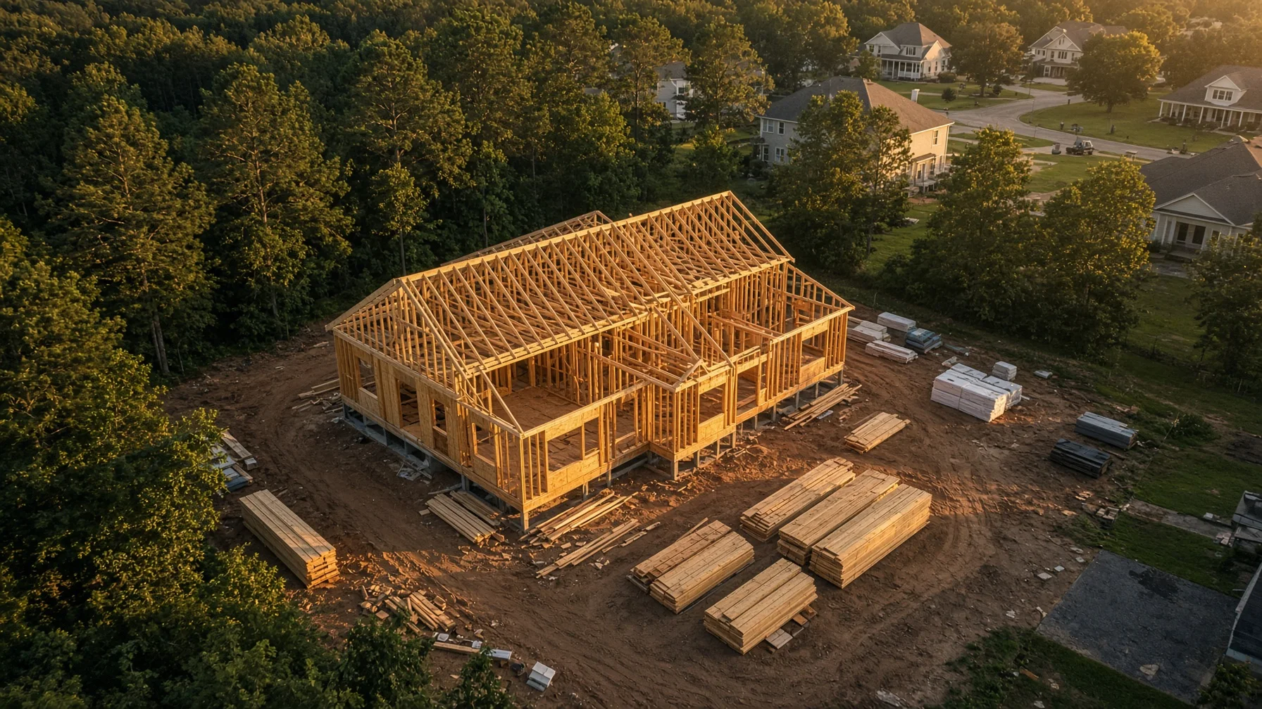
Watching a home rise from a cleared lot is exciting, but construction moves faster than most people realize. Trenches disappear under concrete. Framing is covered by sheathing and finishes. Drainage work, roof details, site grading, and utility routes can become difficult to see once the next phase begins.
That is why construction progress photography is most useful when it follows a plan. A drone can provide a consistent view of the entire property, but the value does not come from simply flying over the site whenever someone remembers. The value comes from capturing the right angles at the right milestones and organizing the files so they remain useful months or years later.
This guide is for residential homeowners, builders, remodelers, and project managers who want a practical aerial record of a house under construction. It is not a substitute for inspections, surveys, engineering reports, or code documentation. It is a visual communication and recordkeeping tool.
What Drone Progress Photos Can Actually Do
Aerial images are especially good at showing relationships that are hard to understand from the ground. A wide overhead image can show the home’s position on the lot, driveway alignment, drainage paths, material staging, access routes, and the surrounding property in one frame.
A repeated oblique image from the same corner can show changes in roof framing, exterior walls, porches, decks, landscaping, and grading. When those images are captured from similar positions over time, they become much more useful than a collection of unrelated snapshots.
For homeowners, the images can make remote updates easier to understand. For builders, they can support owner communication, internal progress meetings, subcontractor coordination, and a final project story. They can also help preserve a visual reference of work that later becomes concealed.
However, a drone photo is not proof that work meets code, dimensions are correct, boundaries are accurate, or hidden systems were installed properly. Aerial photography should support—not replace—the professionals responsible for those determinations.
The Best Time to Start Is Before the First Flight
Before hiring a pilot or launching a company drone, decide what the photo record needs to accomplish.
A homeowner mainly interested in a keepsake may need fewer flights and more visually polished images. A builder using the photos for recurring client updates may need standardized framing and quick delivery. A project manager comparing site changes may care more about consistency than dramatic composition.
Write down the purpose in one sentence. For example:
“Create a clear monthly record of exterior construction and site conditions for the homeowner.”
Or:
“Document major residential construction milestones from repeatable aerial viewpoints for progress meetings and final marketing.”
That sentence will guide the schedule, shot list, delivery format, and budget.
A Practical Residential Construction Flight Schedule
Not every project needs weekly drone coverage. For many single-family homes, milestone-based flights provide a better balance of usefulness and cost.
1. Existing Site or Pre-Construction
Capture the lot before clearing or major disturbance. Useful views include the full parcel area visible from the air, road access, neighboring context, existing trees, visible drainage features, and the planned building area.
This creates a baseline. It can be especially helpful when the site changes significantly during clearing and grading.
2. Clearing, Grading, and Foundation Preparation
Photograph the site after major clearing and during early earthwork. Capture access paths, excavation, visible drainage work, foundation layout, and the relationship between the house location and surrounding grade.
Avoid describing these images as a boundary survey. Property lines shown on consumer mapping tools may be approximate, and a drone image does not establish a legal boundary.
3. Foundation or Slab Milestone
A flight near the foundation stage can show the building footprint, driveway approach, porches, visible utility trenches, and overall placement before framing changes the view.
Ground-level photographs are still essential for details that cannot be seen clearly from above. The aerial set should complement the builder’s normal documentation.
4. Framing and Roof Structure
This is often one of the most visually informative stages. Oblique views can show the shape of the home, rooflines, dormers, decks, attached garages, and exterior openings before finishes are installed.
The pilot should avoid flying through or too close to unfinished framing. Construction sites can contain cranes, temporary power lines, loose materials, workers, and changing hazards.
5. Dry-In and Exterior Installation
Once roofing, windows, doors, and exterior materials are being installed, repeat the standard angles. This stage is useful for showing roof coverage, exterior progress, porch details, siding or masonry work, and remaining site activity.
A drone image may reveal a visible issue worth a closer look, but it should not be presented as a roof inspection unless the service and operator are qualified and contracted for that purpose.
6. Final Grading, Landscaping, and Completion
The final construction set should mirror the early viewpoints whenever possible. Capture the completed roof, exterior elevations, driveway, walkways, landscaping, drainage features visible from the air, and the relationship between the finished home and the lot.
A separate polished “home portrait” session may be appropriate after equipment, dumpsters, temporary fencing, and leftover materials are removed.
Build a Repeatable Shot List
Consistency is what turns progress photos into a sequence.
A useful basic shot list might include:
- One near-vertical overhead view centered on the home site
- Four oblique views from the front-left, front-right, rear-left, and rear-right
- One street-approach view showing the home from the primary access direction
- One wider context view showing the lot and nearby surroundings
- One focused view of a changing feature, such as a pool, detached garage, major retaining wall, or long driveway
The exact aircraft position will vary with airspace, obstacles, sun angle, wind, neighboring properties, and construction activity. The goal is not perfect mathematical duplication. The goal is recognizable, repeatable composition.
Ask the pilot to save a simple reference sheet showing the preferred viewpoints. On future visits, the pilot can use the prior set as a visual guide.
Keep the Images Useful, Not Just Attractive
Construction progress photography serves a different purpose from finished real estate marketing.
For progress sets, clarity matters more than dramatic editing. The images should have natural color, readable detail, and enough context to understand what changed. Heavy filters, aggressive sky replacement, or distracting effects can make comparisons harder.
Request both a curated set and, when appropriate, a consistent naming structure. A practical filename might look like:
2026-07-31_front-left_framing.jpg
Or:
Lot-12_2026-07-31_overhead.jpg
Store each flight in a dated folder. Keep a simple index that lists the construction stage, date, and any unusual conditions such as rain, standing water, temporary access limitations, or incomplete exterior work.
For a long project, a contact sheet or side-by-side comparison can be more useful than sending dozens of individual files.
Questions to Ask Before Hiring a Drone Pilot
Residential construction photography is usually a business use, so the operator should be able to explain how the flight will comply with applicable FAA requirements.
Ask:
- Will the flight be conducted under Part 107 by a certificated remote pilot?
- Is the aircraft properly registered and compliant with Remote ID when required?
- Have you checked the airspace and any temporary restrictions for the scheduled date?
- Will controlled-airspace authorization be obtained through LAANC or another FAA process when necessary?
- How will you avoid workers, vehicles, cranes, power lines, neighboring homes, and other site hazards?
- Can you repeat the same core viewpoints on future visits?
- What files, resolution, usage rights, and delivery timeline are included?
- What happens if weather, airspace restrictions, or active construction make the flight unsafe?
The FAA states that drones used under Part 107 must be registered, and drones that are required to be registered generally must comply with Remote ID. Flights in controlled airspace require authorization. LAANC can provide near-real-time authorization in eligible areas, but pilots must still check other restrictions, notices, and conditions.
A professional answer should be clear and specific. “We have flown there before” is not a substitute for checking the conditions for the actual flight.
Coordinate With the Builder Before Arrival
The pilot should not arrive at an active construction site without coordination.
Choose a site contact who can confirm access, active equipment, crane operations, concrete deliveries, roofing crews, temporary power lines, and any areas that should not be entered. The pilot needs a safe takeoff and landing area away from workers, dust, loose debris, and vehicle traffic.
The best flight time may not be the prettiest time of day. A quiet morning before deliveries begin may be safer than golden hour during heavy site activity. Wind, glare, shadows, and the direction of the home’s main elevation also affect image quality.
When workers are present, the pilot must plan around them rather than treating them as background scenery. FAA rules concerning operations over people and moving vehicles can affect how and where a flight is conducted.
Privacy and Neighboring Property
Aerial construction photos will often include neighboring homes or yards in the wider background. Keep the framing focused on the project property and avoid unnecessary close views into adjacent private areas.
Homeowners and builders should also decide who receives the images and whether any set will be posted publicly. Progress photos may reveal building materials, site access, equipment, or times when the property is unoccupied.
A practical approach is to separate internal progress documentation from public marketing images. The internal set can be comprehensive; the public set can be selected more carefully.
What Drone Progress Photos Should Not Be Used to Claim
To keep the record honest, do not describe ordinary aerial images as:
- A legal property survey
- A code inspection
- An engineering evaluation
- Proof that hidden work was completed correctly
- A certified roof inspection
- A guarantee against defects
- Precise measurement data unless the service was specifically designed, controlled, and delivered for that purpose
A well-organized photo record is valuable because it shows visible conditions at a moment in time. Its usefulness depends on accurate labeling and reasonable expectations.
A Simple Deliverable Package
For a typical residential construction milestone, a useful delivery might include:
- 8 to 15 edited high-resolution images
- A smaller web-ready copy of each image
- A dated folder with consistent filenames
- A one-page contact sheet
- A short note identifying the milestone and flight date
- Optional before-and-after comparison images at later stages
Video can be useful for major milestones, but it is not always necessary. A consistent still-photo sequence is usually easier to compare, archive, email, and reference during a meeting.
The Bottom Line
Drone construction progress photos work best when they are planned as a record, not collected as occasional decoration.
Start with a clear purpose. Choose the milestones that matter. Use a repeatable shot list. Coordinate with the active jobsite. Keep files organized and label their limits honestly. When those pieces are in place, aerial photography can help homeowners and builders understand the project, communicate more clearly, and preserve the story of how the home was built.
Frequently Asked Questions
How often should a new home be photographed by drone?
For many single-family projects, milestone flights are more useful than an arbitrary weekly schedule. Common points include pre-construction, grading, foundation, framing, dry-in, exterior completion, and final landscaping. More frequent coverage may make sense for remote owners or complex projects.
Can drone photos replace a home inspection or building inspection?
No. Ordinary drone progress photos are visual documentation. They do not replace code inspections, surveys, engineering evaluations, or a qualified home inspection.
Can a builder fly a drone over its own project without a Part 107 certificate?
When a drone is used for a business purpose, the operation generally falls under Part 107 rather than the recreational exception. The remote pilot conducting the operation should meet the applicable FAA requirements.
Can drone photos show exact property lines?
A standard aerial photo does not establish legal property boundaries. Any overlaid line should be clearly described as approximate unless it comes from appropriate surveying work and is used within that professional context.
What should be included in a construction progress photo package?
A practical package usually includes repeatable overhead and oblique views, high-resolution files, web-ready copies, dated filenames, and a contact sheet or comparison page.
SOURCE NOTES
Federal Aviation Administration — Remote Identification of Drones
https://www.faa.gov/uas/getting_started/remote_idFederal Aviation Administration — How to Register Your Drone
https://www.faa.gov/uas/getting_started/register_droneFederal Aviation Administration — UAS Data Exchange (LAANC)
https://www.faa.gov/uas/getting_started/laancFederal Aviation Administration — Part 107 Airspace Authorizations
https://www.faa.gov/uas/commercial_operators/part_107_airspace_authorizationsFederal Aviation Administration — Airman’s Information Manual, UAS Airspace Access
https://www.faa.gov/air_traffic/publications/atpubs/aim_html/chap11_section_4.htmlNational Association of Home Builders — Residential Construction Pro Knowledge Library
https://elearning.nahb.org/products/residential-construction-pro-knowledge-library