 By Bobby Rahm · August 9, 2026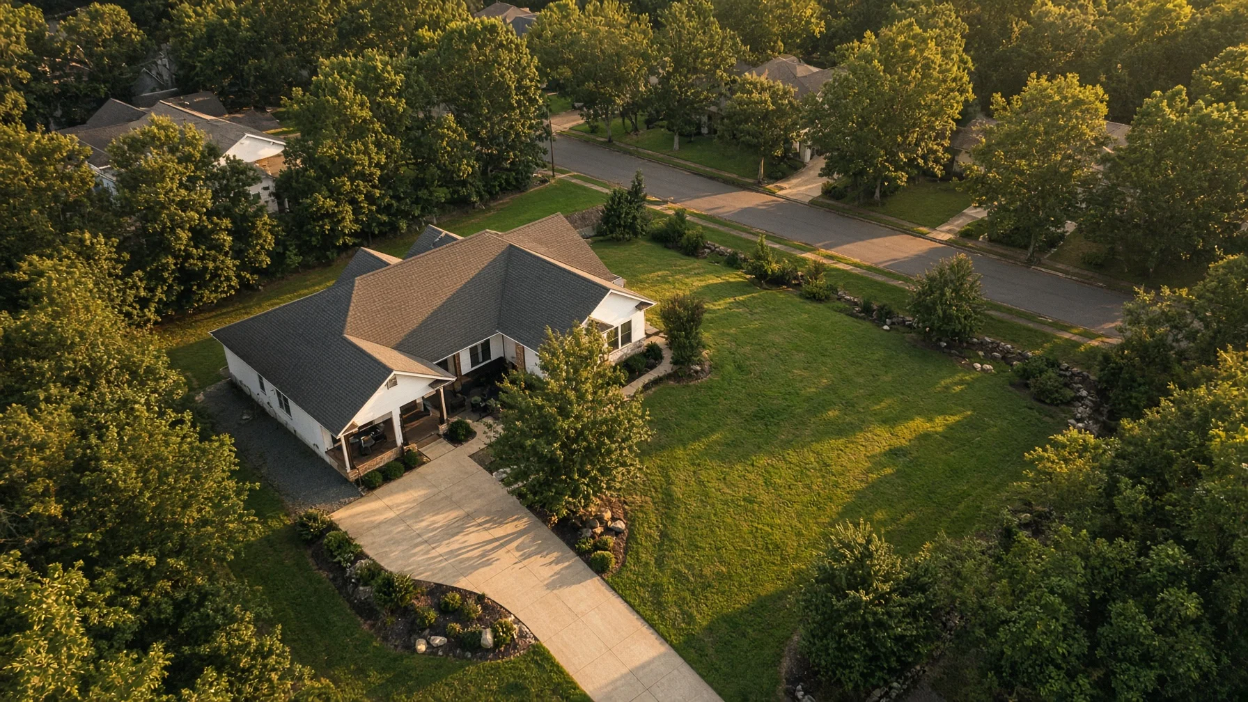
Drone photography has become common in real estate marketing, but common does not mean necessary for every property. Aerial images are most useful when they reveal something buyers cannot understand from the driveway, the front porch, or a standard interior photo set.
For some homes, a drone image immediately explains the property. It can show acreage, a waterfront position, a long private drive, a detached workshop, a new subdivision, or the relationship between the house and nearby amenities. For other homes, aerial photos may add little beyond a wider view of the roof and surrounding rooftops.
The right question is not, “Are drone photos impressive?” They often are. The better question is, “Will aerial images help a buyer understand this specific property faster and more accurately?”
When drone photography usually adds value
Large lots and acreage
A standard exterior photo can show the house, but it may not explain the land. Drone images can help buyers see the size and general shape of a large lot, the position of outbuildings, open fields, wooded areas, fencing, ponds, and long driveways.
This is especially useful when the land is a meaningful part of the asking price. A buyer considering a small farm, rural home, equestrian property, or multi-acre tract usually wants context, not just close-up photos of the structure.
Aerial images should not be presented as a survey or exact boundary map unless the information comes from an appropriate source and is clearly labeled. Their job is to improve visual understanding, not replace legal documents.
Waterfront, mountain, and view properties
If location is one of the property’s strongest features, aerial photography can make that advantage visible. A drone may show the distance between the home and the shoreline, the direction of a mountain view, the position of a dock, or the way a house sits above the surrounding landscape.
Ground photos often capture the view from one room or deck. Aerial images can show why that view exists and how the property relates to the terrain around it.
Homes with multiple structures or major outdoor features
A property with a detached garage, guesthouse, pool, tennis court, workshop, barn, outdoor kitchen, or large landscaped yard may be difficult to explain in a standard photo sequence. Aerial images can connect those features in one frame.
This is useful because buyers do not always understand layout from a list of separate photos. One overhead or angled image can show how the home, driveway, pool, and secondary buildings fit together.
New construction and residential developments
For builders, aerial photos can show the placement of a new home within a lot, the progress of nearby construction, the street pattern of a development, and access to shared features. They can also provide a cleaner visual record during different stages of construction.
For an individual seller, a drone image may help show that the home is on a quiet cul-de-sac, near a community entrance, or positioned beside green space. Those claims still need to be accurate and should not be exaggerated.
Homes near desirable neighborhood features
Aerial photography can be helpful when a property is genuinely close to a park, trail, lake, marina, school, town center, or other visible amenity. It can show proximity more clearly than a sentence in the listing description.
The image should not imply private access, ownership, or a shorter distance than actually exists. Honest context is more valuable than aggressive visual marketing.
When drone photos may not add much
A typical home on a tight suburban lot
If the home is surrounded closely by similar houses and has no major outdoor feature, an aerial photo may mostly show neighboring roofs, streets, and backyards. That can add clutter rather than value.
In this situation, strong ground-level exterior photography, clean interior images, and a well-planned photo order may do more for the listing than a high overhead shot.
A property with visual distractions nearby
Aerial views can reveal useful context, but they can also reveal things a ground photographer can minimize: a commercial property behind the house, heavy traffic, utility infrastructure, construction activity, or neglected neighboring lots.
This does not mean the property should be marketed deceptively. It means the photographer and agent should decide whether an aerial view helps buyers understand the home or simply creates a less focused first impression.
A home where the interior is the main selling point
Some homes are purchased because of craftsmanship, renovation quality, historic details, kitchen design, layout, or interior finishes. If the lot and surroundings are ordinary, the marketing budget may be better spent on excellent interior photography, twilight exterior images, floor plans, or a short walkthrough video.
Drone photography should support the strongest sales story. It should not be included only because other listings use it.
Poor weather, heavy tree cover, or seasonal limitations
Aerial photography is highly dependent on conditions. Flat gray light, high wind, haze, leafless landscaping, harsh midday shadows, or heavy summer tree cover can reduce the usefulness of the final images.
Sometimes postponing the flight produces better results. In other cases, the home may photograph more effectively from the ground. A professional should be willing to say when flying will not materially improve the listing.
The five-question decision test
Before booking drone photography, sellers and agents can ask five practical questions.
- Is there an important property feature that is hard to show from the ground?
Examples include acreage, water access, a detached building, a long driveway, a large backyard, a pool, or a relationship to nearby amenities.
- Will an aerial image help a buyer understand the property faster?
The strongest drone photos explain layout, scale, or location. If the image is only decorative, it may still be attractive, but it is less essential.
- Is the surrounding context an advantage?
Aerial photography is especially effective when the home’s position is part of the value. If the surrounding view creates confusion or distraction, a different visual approach may be stronger.
- Is the likely buyer interested in land, access, or outdoor features?
Buyers shopping for rural property, waterfront homes, new construction, large lots, or recreational features often benefit from aerial context more than buyers comparing similar homes on small lots.
- Can the flight be completed safely and legally?
Real-estate photography performed to help market a property is a non-recreational operation. The FAA identifies taking photos to help sell a property as an example of work that generally falls under Part 107. The pilot must follow applicable operating rules and may need airspace authorization in controlled airspace.
What to ask a drone photographer
A seller does not need to become an aviation expert, but a few questions can reveal whether the photographer is prepared.
Ask whether the flight will be conducted under the appropriate FAA rules, whether the pilot has checked the airspace, and whether weather or nearby obstacles could affect the shoot. Ask what the final package includes and whether the images will be edited for consistent color and exposure.
It is also helpful to ask what the photographer believes the drone will show. A good answer should be specific to the property. “It will show the lot depth, the pool, and the relationship to the lake” is more useful than “Drone photos look great.”
How many aerial images does a listing need?
Most listings do not need a large block of nearly identical aerial photographs. A few purposeful images are usually more effective than a long sequence of high, wide views.
A practical set might include:
- One angled hero image showing the front of the home and lot
- One wider context image showing the neighborhood or landscape
- One image focused on an important feature such as a pool, dock, acreage, or detached building
- One overhead image when layout is genuinely useful
The best aerial image should usually appear near the front of the listing only when it communicates a major selling point. Otherwise, it can be placed later in the sequence to provide context after buyers have seen the home itself.
Drone photography is a tool, not a requirement
Aerial images can make a listing clearer, more memorable, and easier to evaluate. They are particularly valuable when land, location, outdoor features, or property layout are central to the sale.
But drone photography is not a box that every seller must check. A home with a simple lot and an interior-focused sales story may be marketed more effectively with excellent traditional photography and a thoughtful listing presentation.
The best decision is property-specific. Use drone photography when it explains something important. Skip it when it only adds height without adding understanding.
FAQs
Do drone photos help sell a home faster?
Drone photos can strengthen a listing when they clearly show valuable features, but they do not guarantee a faster sale. Price, condition, location, demand, and the overall quality of the listing remain major factors.
Are drone photos worth it for a small suburban home?
They can be, especially if the home has a pool, corner lot, green-space access, unusual layout, or nearby amenity. For a typical tight lot with no major exterior feature, ground photography may provide more value.
Can a Realtor take drone photos personally?
A Realtor may do so only if the flight complies with the rules that apply to non-recreational operations. The FAA specifically treats photos used to help sell property as non-recreational activity, so the operator generally needs to comply with Part 107 requirements.
Can drone photos show property lines?
They can display approximate overlays for visual reference, but an aerial photograph is not a legal survey. Any boundary information should be clearly labeled and based on an appropriate source.
What happens if the home is near an airport?
The flight may require airspace authorization depending on the location and airspace. A qualified pilot should check the site before the scheduled shoot and explain any restrictions or timing issues.
Source Notes
Federal Aviation Administration, Small Unmanned Aircraft Systems Regulations (Part 107): https://www.faa.gov/newsroom/small-unmanned-aircraft-systems-uas-regulations-part-107
Federal Aviation Administration, Recreational Flyers and Community-Based Organizations: https://www.faa.gov/uas/recreational_flyers
Federal Aviation Administration, Certificated Remote Pilots Including Commercial Operators: https://www.faa.gov/uas/commercial_operators
Federal Aviation Administration, Part 107 Airspace Authorizations: https://www.faa.gov/uas/commercial_operators/part_107_airspace_authorizations